
The Bend
A history of West Lethbridge
Before European settlement, the area now known as Lethbridge was part of the traditional territory of the Blackfoot Confederacy, which included the Kainai (Blood), Piikani (Peigan), and Siksika Nations. The Blackfoot people relied on the region’s grasslands for hunting bison, which were central to their way of life. In the mid-19th century, European traders arrived, establishing Fort Whoop-Up in 1869. This notorious whiskey-trading post became a center for trade between Indigenous peoples and American traders. However, the illegal whiskey trade led to conflicts, prompting the arrival of the North-West Mounted Police (NWMP) in 1874 to restore order.
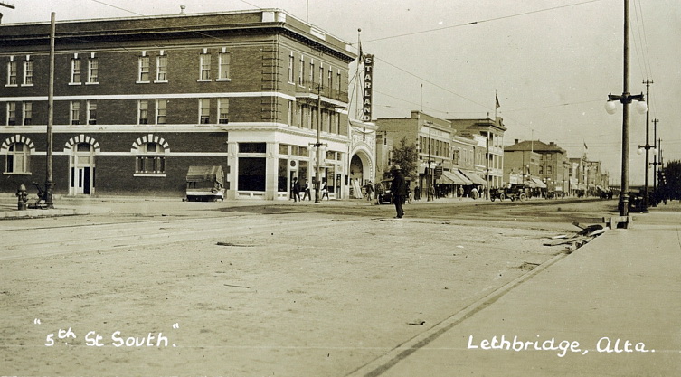
Lethbridge’s modern history began with the discovery of coal. In 1874, Nicholas Sheran, an American entrepreneur, opened the first coal mine in the area. Recognizing the potential for large-scale mining, Sir Alexander Galt and his son Elliott established the North Western Coal and Navigation Company in 1882, leading to the development of drift mines. The company’s first president, William Lethbridge, became the namesake of the town. By the early 20th century, coal mining was the backbone of Lethbridge’s economy. At its peak during *World War I, the region’s mines employed over 2,000 workers and produced 1 million tonnes of coal annually. However, as oil and natural gas gained prominence, coal production declined, and the last mine closed in 1957. The arrival of the Canadian Pacific Railway (CPR) in 1885 transformed Lethbridge into a transportation hub. The railway facilitated coal exports and attracted settlers, leading to the town’s incorporation in 1890. In 1906, Lethbridge officially became a city.
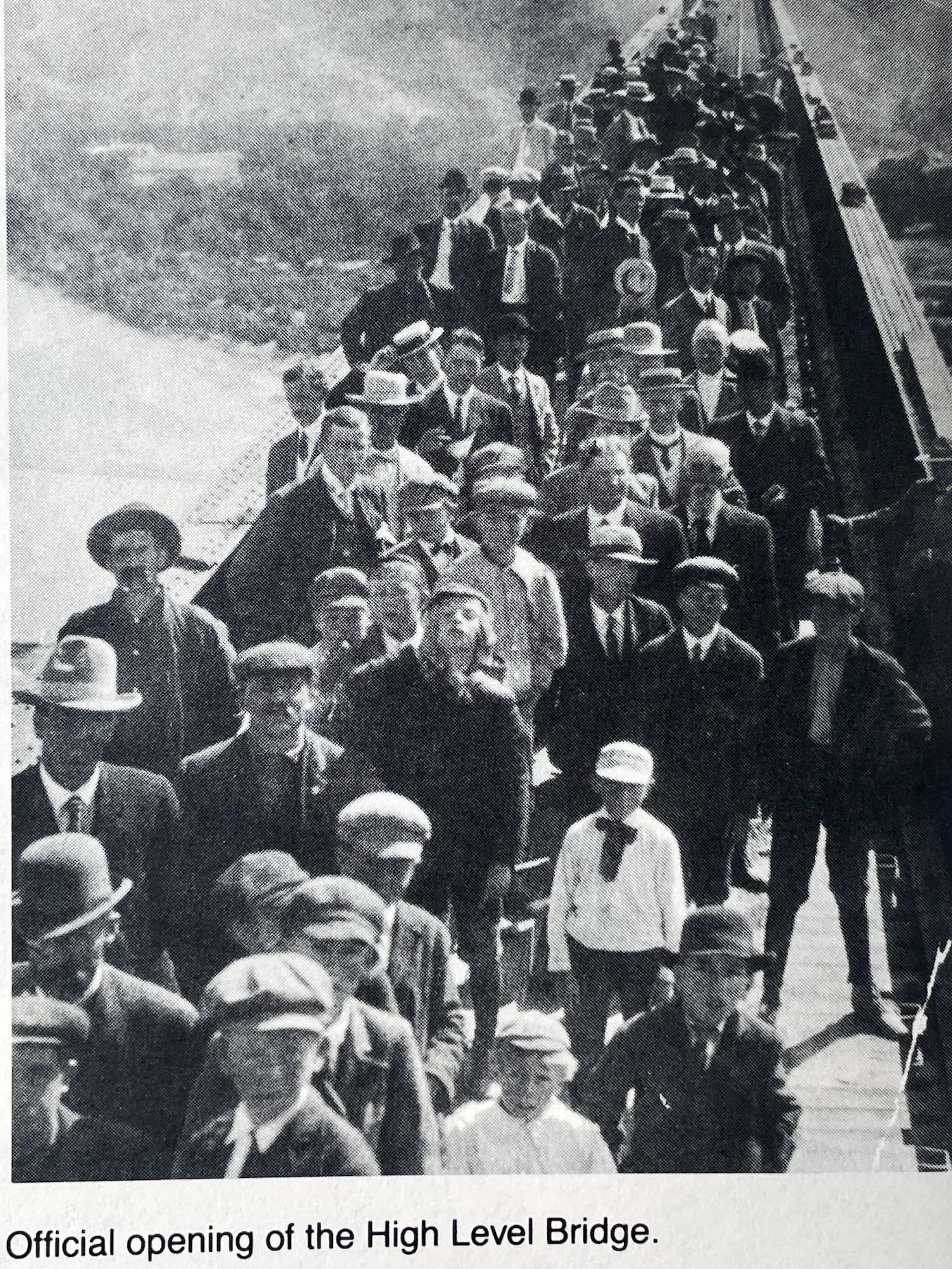
One of Lethbridge’s most iconic landmarks, the High Level Bridge, was completed in 1909. Spanning 1.6 km and towering 96 meters above the Oldman River Valley, it remains the longest and highest steel trestle bridge in North America.
As coal mining declined, agriculture became the dominant industry. Between 1898 and 1900, Mormon settlers from Utah constructed Western Canada’s first large-scale irrigation system, diverting water from the St. Mary River. This innovation transformed Lethbridge into a major agricultural center, supporting wheat farming, cattle ranching, and sugar beet production.
Today, Lethbridge is a vibrant city with a population of nearly 100,000. It is home to Lethbridge College and the University of Lethbridge, both of which contribute to its reputation as an educational and research hub. The city continues to celebrate its Indigenous heritage, coal mining legacy, and agricultural roots through museums, festivals, and historical sites.
Address
Community: Lethbridge
Province: Alberta
Map Location
Latitude, Longitude
49.69632959581873, -112.83940819358911
Map Location
| Surname | Given Name | Book Title | Call No. | Page No. |
|---|---|---|---|---|