
SH 515 & Range Rd 31
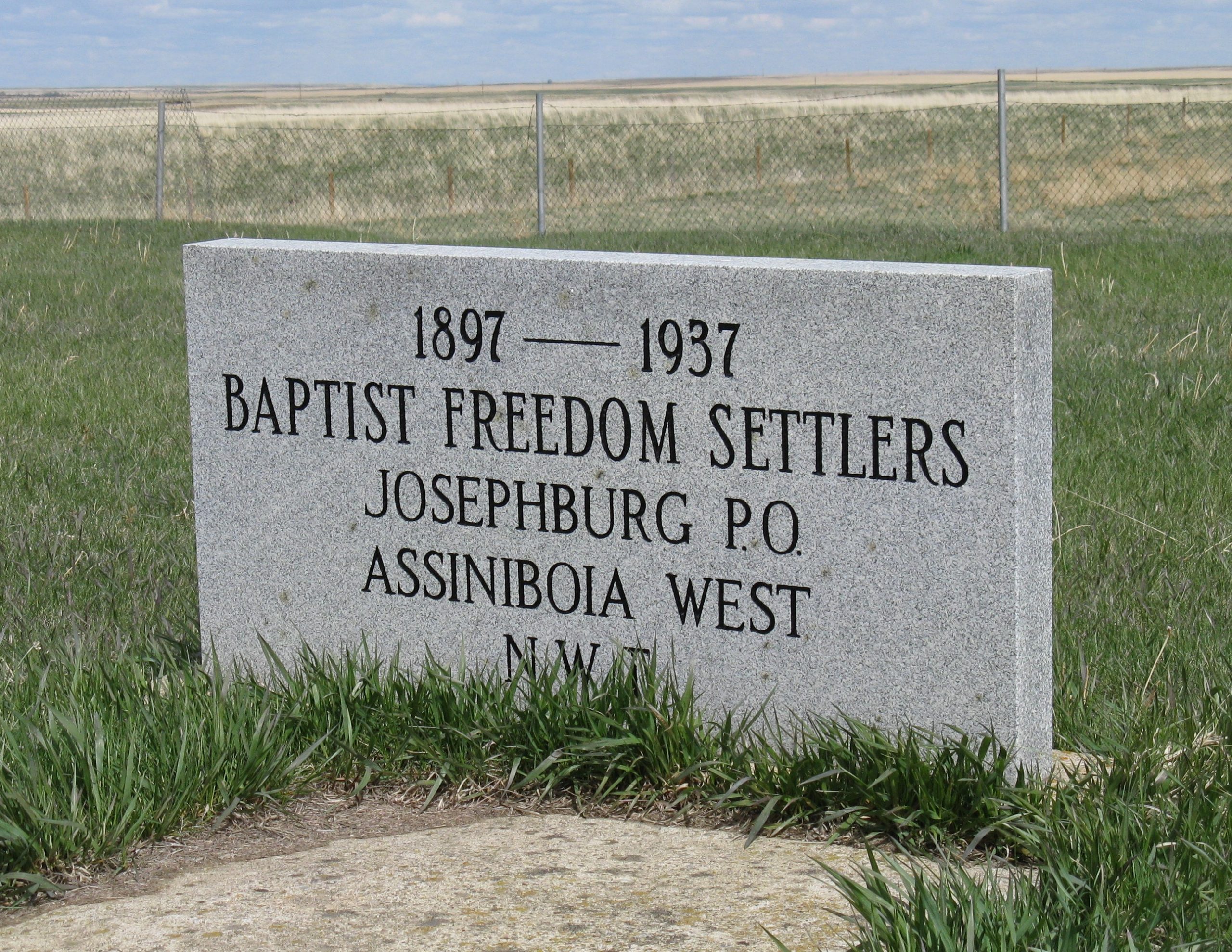
This cemetery is located two miles south of SH 515 on Range Road 3 1 and 200 yards East of Range Road 3 1, or one mile West and twelve miles South of Irvine, Alberta. Legal land description is SW 36-09-03-W4. The cemetery is surrounded by an excellent chain link fence. Unfortunately the grass has not been cut in several years. There are only four grave markers but a stone cairn lists all forty one burials. The inscription on the cairn reads: “1897 to 1937 Baptist Freedom Settlers Josephburg P.O. Assiniboia West N.W.T.”
The congregation of this church was meeting as early as 1896. Mr. Gottlieb Zaiser, one of the areas pioneers, enticed Reverend Gold from Medicine Hat, Alberta, to conduct services in the Zaiser home. The frame church, twenty by thirty six feet with a six foot by six foot extension facing east, was built in 1900. The interior was finished with a tongue and groove ceiling and four foot wainscoat on the walls. The first group of trustees included: G. Zaiser, F. Weiss and A. Wentland. Pastors who served the congregation included: Pastor Hagen 1900 to 1902, and W. Bernard 1903 to 1906. The congregation was served by nonresident ministers from 1907. The church building was dismantled in the 1940’s after not being used since 1937.
Information courtesy of Medicine Hat and District Genealogical Society
Address
SH 515 & Range Rd 31
Nearest Populated Centre: Josephburg,
Province: Alberta
Map Location
Latitude, Longitude
49.77148, -110.29706
Map Location
| Surname | Given Name | Born | Died | Age | Photo(s) | Cemetery | Obituary | Narrative | R Code |
|---|---|---|---|---|---|---|---|---|---|
The 25 most common surnames found in this cemetery.

The 25 most common given names found in this cemetery.