
Township Road 94 and Range Rd 43
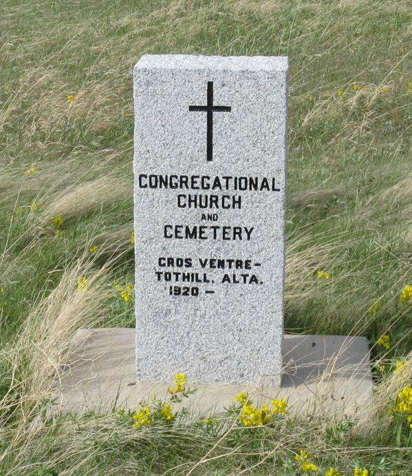
The church and cemetery are situated on a hill south of Medicine Hat, Alberta. Travel south on Eagle Butte Road to township road 94, then two and a half miles east. As at September 06, 1996, a broken-down log church was still on site; one could still see painted walls in the doorways.
The original church building was the vacant home of Johannes Rath which was moved to this site, the homestead of Christian Stuber. Mr. Stuber had donated the property. Ten teams of horses were used to move the heavy log structure.
Some of the founding families were Christian Seitz Andrew Rath, William Krauss, Adam Stuber, Johannes Stuber, Erhardt Stuber, Frederick Rabb and Frederick Jesse.
Courtesy of Medicine Hat and District Genealogical Society (MHDGS)
Address
Township Road 94 and Range Rd 43
Nearest Populated Centre: Gros Ventre - Tothill,
Province: Alberta
Map Location
Latitude, Longitude
49.757231, -110.494026
Map Location
| Surname | Given Name | Born | Died | Age | Photos | Cemetery | R Code |
|---|---|---|---|---|---|---|---|
The 25 most common surnames found in this cemetery.

The 25 most common given names found in this cemetery.