Deaths

Longevity

Address

Range Rd 282, north of Hwy 533
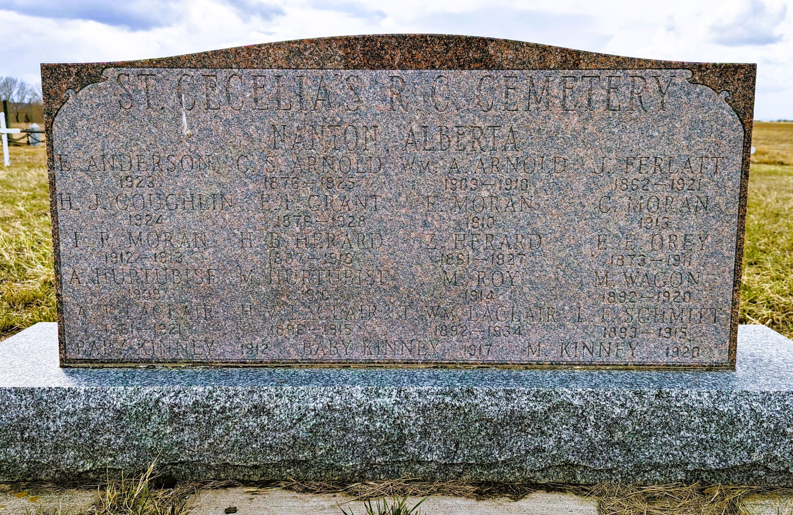
Nearest Populated Centre: Nanton,
Province: Alberta

Map Location

Latitude, Longitude
50.35880, -113.75916

Map Location

Search for:
RESET
Surname Given Name Born Died Age Photo(s) Cemetery Obituary Narrative R Code

The 25 most common surnames found in this cemetery.

loader

The 25 most common given names found in this cemetery.

loader

Other Cemeteries

Faith Union Cemetery (Forty Mile County)

Township Road 42 and Highway 885 , Etzikom , Alberta

Gnadenfeldt Baptist Cemetery (Cypress County)

Twp Rd 202 & Rge Rd 12 , Sandy Point , Alberta

Hutton-Pandora Cemetery (Special Area No. 2)

Township Road 242 E of Highway 36 , Hutton , Alberta

Bauder Family Cemetery (Cypress County)

Twp Rd 143 & Rge Rd 11 , Many Islands Lake , Alberta

Knee Hill Valley Divide Cemetery (Red Deer County)

Twp Rd 350 west of Rge Rd 264 , Knee Hill Valley , Alberta

Canmore Old Cemetery (MD of Bighorn)

1250 Palliser Trail , Canmore , Alberta

Sarcee Butte Cemetery (Kneehill County)

311012 Range Road 221 , Three Hills , Alberta

Schlaht Cemetery (Cypress County)

Township Road 112 and Range Road 21 , Irvine , Alberta

Meadow Vale Cemetery (Ponoka County)

Township Road 430 W of Range Road 50 , Rimbey , Alberta

St. Joseph's Cemetery (Foremost, Forty Mile County)

Township Road 72 and Range road 113 , Foremost , Alberta

Discover Alberta Ancestors