
Our People in a Land of Green and Gold
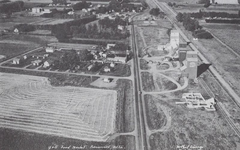
Barnwell, located in southern Alberta, has a history deeply tied to the Canadian Pacific Railway (CPR) and early settlement efforts. The area was originally known as Woodpecker, named after a boxcar stationed on a rail siding that served as a telegraph office for local settlers. In 1908, the name was changed to Bountiful, but due to another community already holding that name, it was soon renamed Barnwell after William Barnwell, a longtime CPR employee.
During the early 20th century, Barnwell became a hub for agriculture and Mormon settlers, who played a significant role in shaping the community. By 1911, members of The Church of Jesus Christ of Latter-day Saints had established multiple communities across southern Alberta, including Barnwell. The village continued to grow, officially incorporating on January 1, 1980. Today, Barnwell remains a small but thriving agricultural community, located 10 km west of Taber and **40 km east of Lethbridge along Highway 3.
Cranford is an unincorporated community in southern Alberta, situated within the Municipal District of Taber. Located along Highway 3, approximately 35 km east of Lethbridge, Cranford has historically served as a small agricultural settlement.
One of the most intriguing aspects of Cranford’s history is its connection to Indigenous heritage. The Cranford Site, located on the south bank of the Oldman River, is a multi-component stone circle site consisting of 87 rings, 5 cairns, a rock alignment, and various lithic concentrations. This archaeological site provides valuable insight into the Indigenous presence in the region, highlighting the cultural significance of the area long before European settlement.
While Cranford itself has remained a quiet rural locality, its historical significance is preserved through archaeological studies and local heritage efforts. The community continues to be a part of Alberta’s agricultural landscape, contributing to the province’s farming industry.
Address
Community: Barnwell
Province: Alberta
Map Location
Latitude, Longitude
49.76137429096854, -112.26543374038555
Map Location
| Surname | Given Name | Book Title | Call No. | Page No. |
|---|---|---|---|---|