
Range Rd 104, Township Rd 154
The village of Carlstadt, “Star of the Prairie” was born in 1910. The name change to Alderson occurred in May 1915, during World War I. Because of the war, the residents were ashamed of the German connotation of the name Carlstadt and held a contest to rename their town. It was platted as a major distributing center along two main thoroughfares, Railway Avenue running east-west with the tracks to the north and Broadway Street heading south.
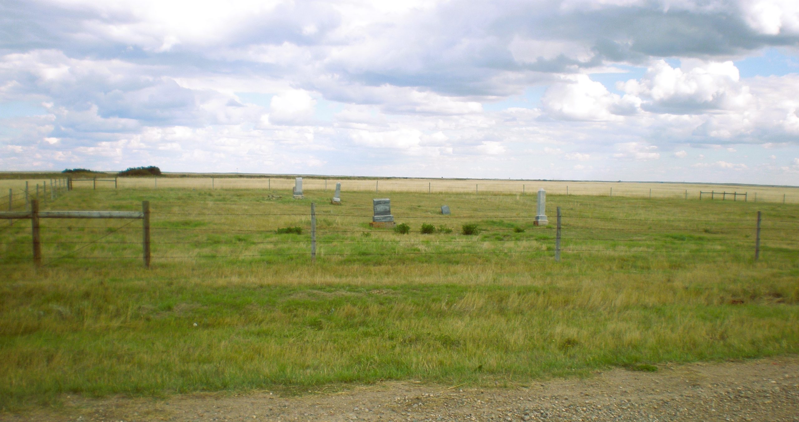
Today, all that remains of this once thriving town located next to the Canadian Pacific Railway west of Suffield, Alberta, are a few junk filled basements, one with a large poplar tree growing out of it, and the one acre cemetery just south of the railway tracks. The complete history of this town can be found in the book “Empire of Dust” printed in 1987, written by David C. Jones.
The cemetery is located just one half mile west of Range Road 104 almost one mile south of Township Road 154 and south of the railway track. The two acres of land for this plot were donated by Mr. Tom Swanby. The plot is well fenced with barbed wire, the natural grasses have not been cut in several years. There seems to be no set pattern for the estimated 50 graves in this cemetery. Eleven graves are clearly marked with legible stones while several others are outlined with a wooden frame or small metal marker. Numerous depressions or mounds indicating other burials are haphazardly spread over the entire area.
Several sources indicate that at least three graves are located in Gasson’s trees southeast of Alderson, the wife was killed by a team of horses. A child is buried four miles from the Nels Anderson homestead. There are three or four graves on a farm north of Alderson, the family moved to Chicago. A horticultural station worker for Southern Alberta Land Company froze to death at Ronnelane and is probably buried at Alderson. A search at provincial archives turned out to be futile, these records as well as many others have simply disappeared.
Information courtesy of Medicine Hat and District Genealogical Society
Address
Range Rd 104, Township Rd 154
Nearest Populated Centre: Alderson,
Province: Alberta
Map Location
Latitude, Longitude
50.27394, -111.33302
Map Location
| Surname | Given Name | Born | Died | Age | Photos | Cemetery | R Code |
|---|---|---|---|---|---|---|---|
The 25 most common surnames found in this cemetery.

The 25 most common given names found in this cemetery.