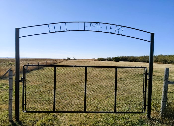
This cemetery is also known as Evangelical Lutheran Church of Canada.

The Manyberries, Evangelical Lutheran Church of Zion Cemetery is located on SE18-06-5-W4 on Township Road #62 at its intersection with Range Road #55, east of Secondary Highway #889.

Courtesy of Medicine Hat and District Genealogical Society (MHDGS)

Deaths

Longevity

Address

Township Road 62 and Range Road 55, east of Highway 889
Nearest Populated Centre: Manyberries,
Province: Alberta

Map Location

Latitude, Longitude
49.46524, -110.65716

Map Location

Search for:
RESET
Surname Given Name Born Died Age Photos Cemetery R Code

The 25 most common surnames found in this cemetery.

loader

The 25 most common given names found in this cemetery.

loader

Other Cemeteries

Benalto Cemetery (Red Deer County)

Range Road 25 S of Township Road 385 , Benalto , Alberta

Ebenezer Cemetery (Forty Mile County)

Township Road 84 and Range Road 71 , Seven Persons , Alberta

Manyberries Cemetery (Forty Mile County)

Highway 61 (Red Coat Trail) and Range Road 53b , Manyberries , Alberta

Blairmore Catholic Cemetery (Crowsnest Pass)

25th Ave , Blairmore , Alberta

Lacombe Home Cemetery (Calgary)

270 Providence Boulevard SE , Calgary , Alberta

Chevra Kadisha Erlton Street Cemetery (Calgary)

32 30th Ave SW , Calgary , Alberta

Beazer Cemetery (Cardston County)

Beazer Cemetery Road N of Range Road 272 , Beazer , Alberta

Caldwell-Moir Cemetery (Cardston County)

Range Road 280 S of Township Road 25A/B , Mountain View , Alberta

Glen Banner Lutheran Cemetery (Forty Mile County)

Township Road 72 and Range Road 64 , Orion , Alberta

Banff Town Cemetery (Banff National Park)

604 Buffalo Street , Banff , Alberta

Discover Alberta Ancestors