
Rge Rd 21 and Hwy 528
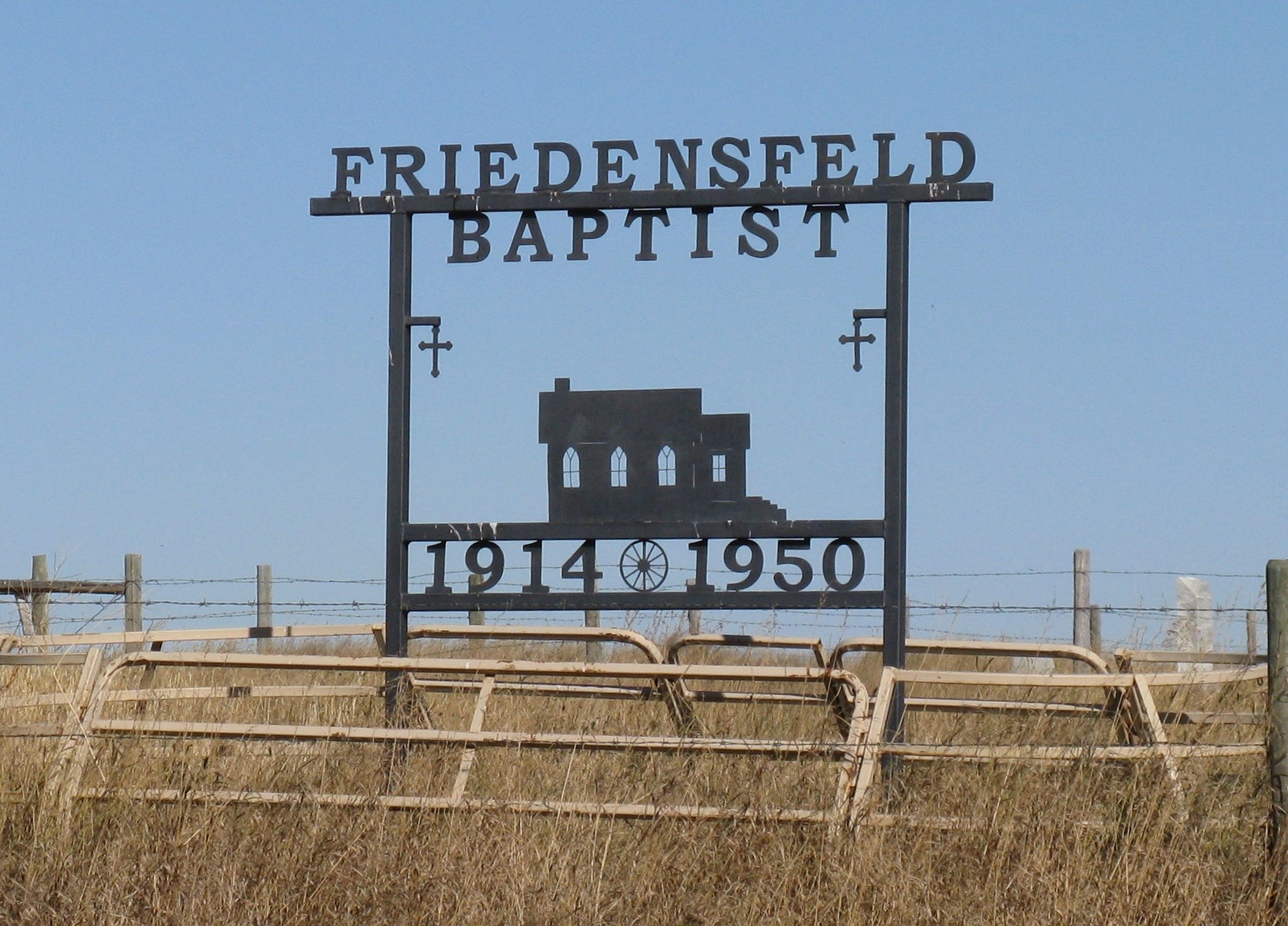
The piece of property for this church and cemetery was donated by Mr. August Reich. The Friedensfeld Baptist Church was a mission station of Hilda, Alberta. Early in 1917 John Herrmann Sr. and Jacob Will Sr. organized a group in the area and went ahead with the construction of a church. Up to this time worship services were held on a rotating basis in homes, and later in the Friedensfeld school. The name for the district was suggested by Mrs. Jacob (Caroline) Will.
The first board of directors consisted of John Herrmann Sr., Jacob Will Sr., Jacob Schafer, August Reich, Carl Herrmann, Fred Ulrich, Carl Dickhaut Sr., Jacob Will Jr., and Carl Dickhaut Jr. All labor for construction was volunteered. The first pastor to serve this new congregation was Reverend E.P. Wahl. Other pastors who served Friedensfeld were: Reverends Matz, Paefinier and Feisel. This group like others were extremely active, the community seemed to revolve around the church.
A talented young settler, Julius Littke, organized a brass band and played at church functions. The church was sold and moved from this location, today all that remains is another neglected cemetery. The cemetery is located on a desolate hilltop just north of SH 528 and just west of Range Road 21, two miles west, six miles south and one and a half miles west of Schuler, Alberta. The one-acre property is surrounded by a good fence, sage brush and other native grasses that have not been cut in some years as of time of writing August 31, 1996.
Information courtesy of Medicine Hat and District Genealogical Society (MHDGS)
Address
Rge Rd 21 and Hwy 528
Nearest Populated Centre: Schuler,
Province: Alberta
Map Location
Latitude, Longitude
50.25231, -110.16764
Map Location
| Surname | Given Name | Born | Died | Age | Photos | Cemetery | R Code |
|---|---|---|---|---|---|---|---|
The 25 most common surnames found in this cemetery.

The 25 most common given names found in this cemetery.