Twp Rd 174 & Range Rd 12
The Hilda Baptist Church has its beginnings in 1910. The first meeting was held in the home of George Heitzmann with 23 charter members attending. Reverend F.A. Mueller was the first pastor. Services were held in the Heitzmann home until the congregation out grew this cozy little house. The decision to build a church was made April 26, 1911. Mr. Heitzmann donated three acres of land for the church and graveyard. Dedication services were held July 15, 1911. The church was renamed from Hilda to Germantown and became a member of the North American Baptist Conference. The membership grew steadily, after five years there were 151 members, resulting in construction of a new building in 1918 under the leadership of Reverend E.P. Wahl.
The building was moved into the hamlet of Hilda, Alberta, in 1928 and rededicated August 12, 1928. Another name change took place, reverting back to the Hilda Baptist Church. The parsonage was torn down and rebuilt in Hilda. In 1958 a new parsonage was built just north of the church. The old church was sold and moved to a local farm and a new church was built in the 1970’s. In the first 63 years to 1974, 23 pastors served the Hilda Baptist Church. They not only served the Hilda church but served Fredensfelt and Neuberg before the 1920’s, as well as Gnadenfeld and Burstall in the 1940’s.
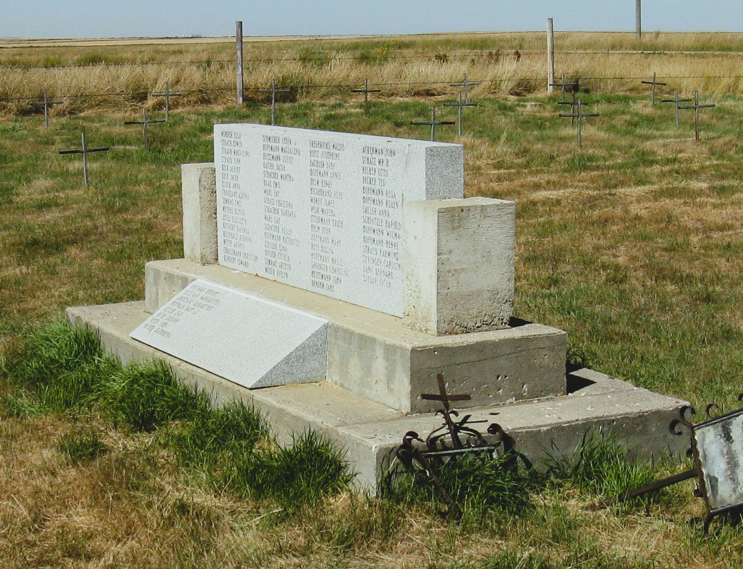
The church remains active and holds combined services with the Evangelical group. The Hilda Baptist cemetery is located one mile west and two miles south of Hilda, Alberta, at the junction of township road 174 and Range Road 12. The congregation has erected a cairn listing those interred here and has marked all graves with a metal cross. There are a couple of discrepancies noted in names recorded on the cairn versus other records, also the cairn shows Mr. and Mrs. Bernard Lang as being interred here, they are interred in Hillside Cemetery at Medicine Hat, Alberta.
Information courtesy of Medicine Hat & District Genealogical Society
Address
Twp Rd 174 & Range Rd 12
City: Hilda,
Province: Alberta
Map Location
Latitude, Longitude
50.45513, -110.05179
Map Location
| Surname | Given Name | Born | Died | Age | Cemetery | Location | Obituary | Narrative | R Code |
|---|---|---|---|---|---|---|---|---|---|
The 25 most common surnames found in this cemetery.

The 25 most common given names found in this cemetery.