Courtesy of Medicine Hat and District Genealogical Society (MHDGS)

Deaths

Longevity

Address

Twp Rd 182 & Range Rd 20
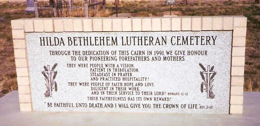
Nearest Populated Centre: Hilda,
Province: Alberta

Map Location

Latitude, Longitude
50.50622, -110.14031

Map Location

Search for:
RESET
Surname Given Name Born Died Age Photos Cemetery R Code

The 25 most common surnames found in this cemetery.

loader

The 25 most common given names found in this cemetery.

loader

Other Cemeteries

Veach Family Cemetery (Stettler County)

Township Road 390 & Range Road 205 , Erskine , Alberta

Carmangay Cemetery (Vulcan County)

Township Road 235 and Range Road 240 , Carmangay , Alberta

Salem Evangelical Cemetery Site 2 (Newburg, Cypress County)

Township Road 102 & Range Road 23 , Newburg , Alberta

Rosemary Catholic Cemetery (Newell County)

Old #1 Highway and East Gem Road , Rosemary , Alberta

Nemiscam Cemetery (Forty Mile County)

Highway 501 (Red Coat Trail) and Range Road 103 , Nemiskam , Alberta

Lacombe Home Cemetery (Calgary)

270 Providence Boulevard SE , Calgary , Alberta

Coffin Handle Butte Cemetery (Vulcan County)

top of Coffin Handle Butte east of Milo AB , Milo , Alberta

St. Francis of Assisi Cemetery (Leduc County)

Highway 770 north of Highway 622 , Thorsby , Alberta

Cravath Corners Cemetery (Wardlow, Special Area No. 2)

Range Road 513 S of Cessford , Wardlow , Alberta

Burnbrae Cemetery (Ponoka County)

Township Road 444 east of Highway 771 , Homeglen , Alberta

Discover Alberta Ancestors