Courtesy of Medicine Hat and District Genealogical Society (MHDGS)

Deaths

Longevity

Address

Twp Rd 182 & Range Rd 20
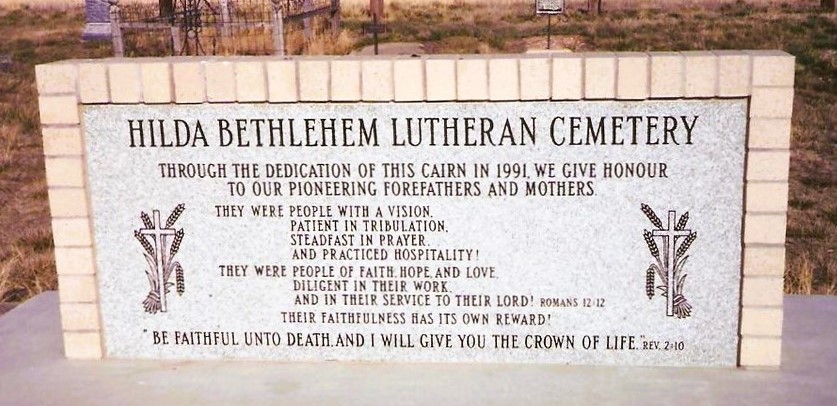
Nearest Populated Centre: Hilda,
Province: Alberta

Map Location

Latitude, Longitude
50.50622, -110.14031

Map Location

Search for:
RESET
Surname Given Name Born Died Age Photo(s) Cemetery Obituary Narrative R Code

The 25 most common surnames found in this cemetery.

loader

The 25 most common given names found in this cemetery.

loader

Other Cemeteries

Evangelical Lutheran Church of Zion (Forty Mile County)

Township Road 62 and Range Road 55, east of Highway 889 , Manyberries , Alberta

Wimborne Cemetery (Kneehill County)

334039 Hwy 805 , Wimborne , Alberta

Kootenai Brown Cemetery (Waterton Lakes National Park)

Highway 5, Waterton Park , Waterton , Alberta

Glen Banner Lutheran Cemetery (Forty Mile County)

Township Road 72 and Range Road 64 , Orion , Alberta

Adam Wolfer Family Cemetery (Cypress County)

Twp Rd 202 & Rge Rd 11 , Sandy Point , Alberta

Bismark Lutheran Cemetery (Ponoka County)

Highway 792 N of Township Road 432 , Crestomere , Alberta

Graburn United Church Cemetery (Cypress County)

Twp Rd 100 & Range Rd 12 (Graburn Road) , Walsh , Alberta

Salem Evangelical Cemetery (Hilda, Cypress County)

Twp Rd 182 & Rge Rd 11 , Hilda , Alberta

Ferrybank Cemetery (Ponoka County)

Highway 795 and Range Road 251 , Ponoka , Alberta

Discover Alberta Ancestors