
27359 Twp Rd 333
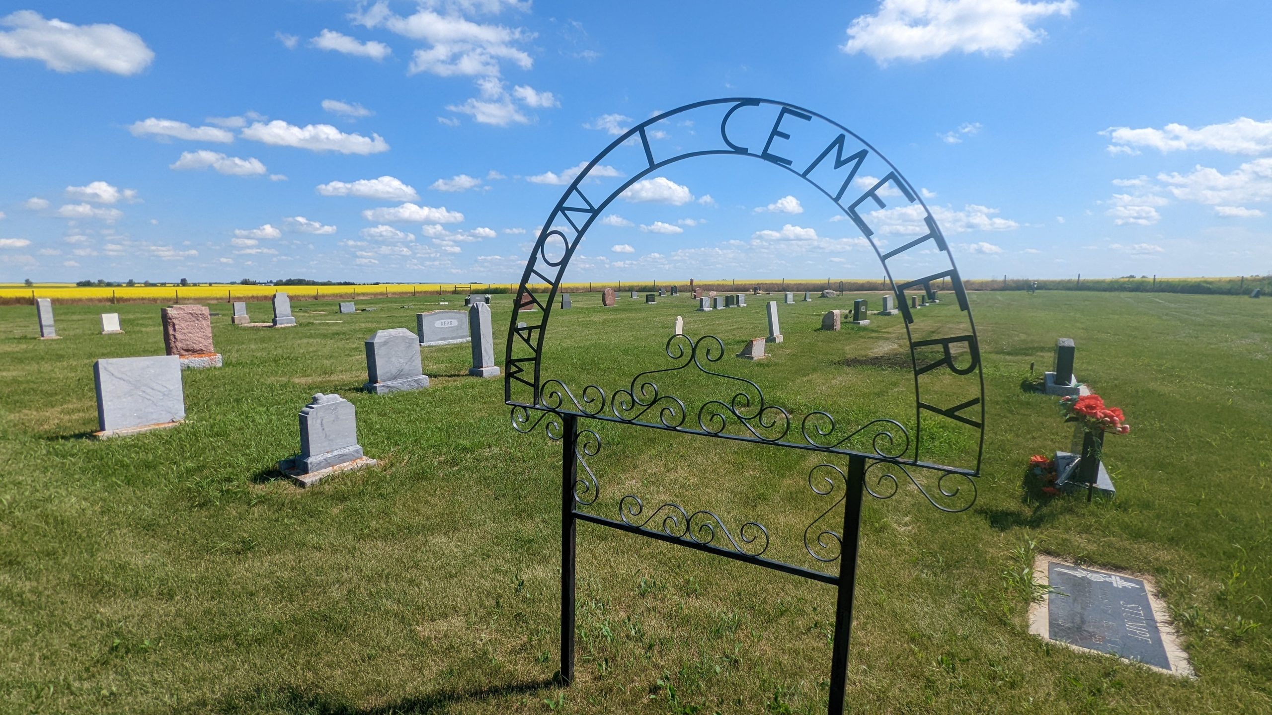
The community of Mayton, about an hour’s drive north of Calgary, started out small, never made it past 50 settlers or so, and in present day there is virtually no trace of Mayton left. Once upon a time a row of buildings stood upon the rural crossroads, giving Mayton a brief glimpse of prosperity and hope. Today, however, there is nothing left at the crossroads. The only real present-day evidence of living souls ever having lived in Mayton is the cemetery of souls just outside where the hamlet once stood.
Seth Cummins, a former settler in Mayton, wrote for the Mayton community book, “Sweaty Brows and Breaking Plows” that “There was a lot of cream hauled (at the town’s large creamery). My granddad and grandma milked sixteen or eighteen cows. They stored the cream in a sod milk house, and once a week granddad hauled it in a steel-lined wooden barrel, perhaps holding twenty-five or thirty gallons of cream, with handles on the side for lifting. “He last hauled there in 1915 with a team and democrat,” continued Seth. “The butter maker that I remember was Charlie Rear and he had a helper. He had to have papers for steam.”
The creamery is since long gone, as are the stores, blacksmith shop and community hall. As those businesses closed and were hauled away, the people left. By the 1960s, there wasn’t a single trace left of Mayton. It became a ghost town, one of many that quietly dot Central Alberta.
Recalls former Mayton resident Glen Cummings, “When I was on my way in, Mayton was on its way out. When Mayton was put there, they thought the railroad would come through on account of the area being flatter land, but it didn’t turn out that way. It came up through the hills to Wimborne. That was in 1929. That pretty well put the end to Mayton. The rail petered out there (Wimborne) and now it is gone too.”
-with information from https://www.ghosttownpix.com/alberta/mayton.html
Address
27359 Twp Rd 333
Nearest Populated Centre: Mayton,
Province: Alberta
Map Location
Latitude, Longitude
51.83839, -113.7776
Map Location
| Surname | Given Name | Born | Died | Age | Photos | Cemetery | R Code |
|---|---|---|---|---|---|---|---|
The 25 most common surnames found in this cemetery.

The 25 most common given names found in this cemetery.