
Township Road 110 east of Highway 867
Starting in about 1908, Sunday School was held every Sunday at 11 :00 a.m. A Presbyterian minister served the community and a Ladies Missionary Society was formed. Reverend McLaren was the first pastor, he served from 1909 to 1910. In 1911, a manse was built by volunteers, half of this home was used for a school with Jim McAskile being the first teacher. The church was built and dedicated in 1916, as well an addition to the manse and a stable were built.Other pastors who served were: Conway, Smith, Gibson, Harback, Sneddon in 1922, J.W. Morrow from Medicine Hat, Alberta, Graham, Miss Elsie Graham, Berg and Lawrence Seibert.
Commensurate with the declining rural population the church was unused for some time. About 1940, community members donated funds to convert the church into a hall to be used for social functions.
When the irrigation scheme in the Seven Persons area was developed in the early 1950’s, several Mennonite families purchased the community hall and renovated it to be used as a church again. This congregation maintained this place of worship for some years until they joined the Crestwood Mennonite Brethern Church at Medicine Hat, Alberta. The building was sold to Mr. and Mrs. Art Herter who converted it to use as their home.
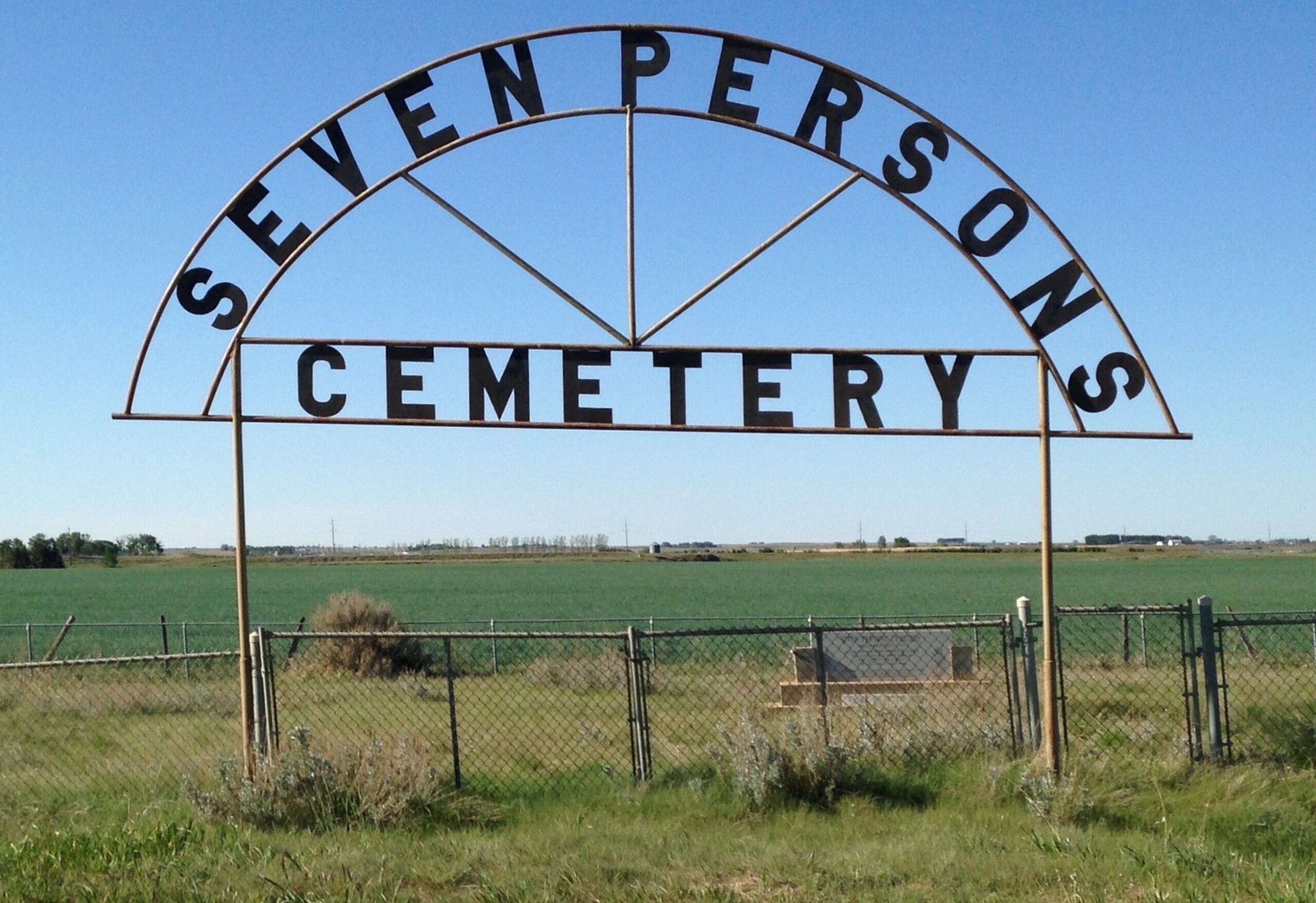
The cemetery is located one mile east of Seven Persons, Alberta, on Township Road 110. This one acre plot is surrounded by a new chain link fence, is identified by a large sign and lists the names of most of those interred here on a stone cairn. The grass needed to be cut as at September 01,1996.
The inscription on the cairn reads: This cairn has been erected to honour the pioneers and their families who settled the district and are laid to rest here. Erected in 1981 by the Department of Alberta Culture, Seven Persons Historical Society and the Alberta 75th. Anniversary Commission. Burials 1908 to 1939. The cairn does not list all death dates, we found names on some markers that were not on the cairn. Much of the following information was found at the Provincial Archives October 14, 1997.
Courtesy of Medicine Hat and District Genealogical Society (MHDGS)
Address
Township Road 110 east of Highway 867
Nearest Populated Centre: Seven Persons,
Province: Alberta
Map Location
Latitude, Longitude
49.87363, -110.88046
Map Location
| Surname | Given Name | Born | Died | Age | Photos | Cemetery | R Code |
|---|---|---|---|---|---|---|---|
The 25 most common surnames found in this cemetery.

The 25 most common given names found in this cemetery.