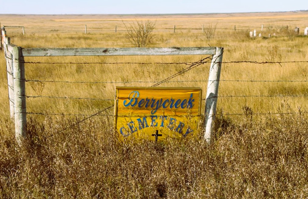
Berry Creek is an abandoned community. It’s closest neighbours of any size are Youngstown and Hanna. The earliest know burial was in 1914.

Deaths

Longevity

Address

Range Road 120 N of Township Road 284
Nearest Populated Centre: Berry Creek,
Province: Alberta

Map Location

Latitude, Longitude
51.42231, -111.55288

Map Location

Search for:
RESET
Surname Given Name Born Died Age Photo(s) Cemetery Obituary Narrative R Code

The 25 most common surnames found in this cemetery.

loader

The 25 most common given names found in this cemetery.

loader

Other Cemeteries

Forty Mile Pioneer Cemetery (Forty Mile County)

Highway 879, Township Road 70, Range Road 112 , Foremost , Alberta

Friedensfeld Baptist Cemetery (Cypress County)

Rge Rd 21 and Hwy 528 , Schuler , Alberta

Munson Cemetery (Starland County)

Highway 9 south of Munson , Munson , Alberta

Sunnyside Cemetery (Forty Mile County)

105040 Twp Rd 12 (Range Rd 150 & Twp Rd 12) , Aden , Alberta

New Home Cemetery (Forty Mile County)

Township Road 63 and Range Road 50A , Manyberries , Alberta

Fertile Plains Cemetery (Forty Mile County)

Highway 885, Township Road 85, Range Road 102 , Maleb, Bow Island area , Alberta

Huber Family Cemetery (Cypress County)

Twp Rd 200 & Rge Rd 11 , Sandy Point , Alberta

Dalemead Cemetery (Rocky View County)

Centre St & Highland Ave , Dalemead , Alberta

Coleman Union Cemetery (Crowsnest Pass)

27 Ave & 28 Ave , Coleman , Alberta

St. Peter's Lutheran Cemetery (Schuler, Cypress County)

Rge Rd 23 between Twp Rd 154 and Hwy 528 , Schuler , Alberta

Discover Alberta Ancestors