
Twp Rd 100 & Range Rd 12 (Graburn Road)
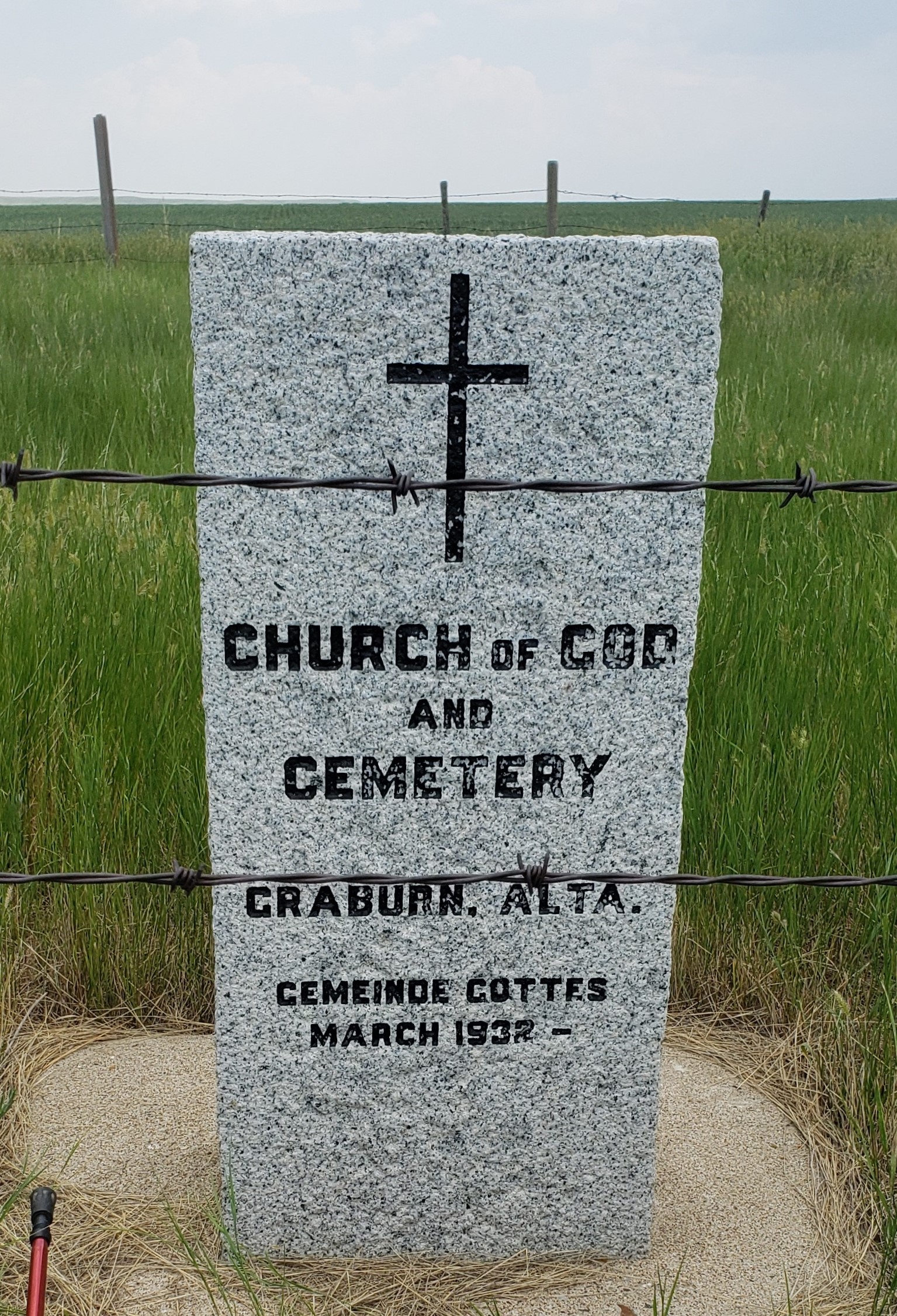
Construction of the Church of God (or “”Gemeinde Gottes” in German) started in March 1932 by a breakaway group from the Graburn United Church after differing opinions about their religion caused a rift. Mr. Henry Reiman donated two acres of land for this site just one mile south of the United Church location. Mr. Reiman, a Lutheran, had originally donated this same piece of property for the construction of a Lutheran church. The lack of interest towards forming a Lutheran congregation left the property empty.
Several of the ministers serving this medium sized congregation were Reverends Wiens, Butgereit, Karl Krause, Albert Schneider, Kowalko and Ralph Farmer. Most of the ministers traveled from Medicine Hat, Alberta, and spent the night with one of the poor and humble families.
Sunday services were usually at 10:00 a.m. followed by lunch in the church and an afternoon service. After a quick trip home to perform the tedious farm chores most members returned for an evening service. During the horse and buggy days, a barn was also constructed on the property. Later, it was sold and moved from the location. In the 1960’s, the building was shared with an Evangelical congregation on alternate Sundays. The building and property were sold in 1957.
The church cemetery is located at the junction of Range Road 12 and one mile south of Township Road 100, or eleven and one half miles south of Walsh, Alberta, on the Graburn Road. The two acre property is overgrown and has become a resting place for abandoned machinery. The old church stands askew in the extreme northwest comer of the plot. The small cemetery in the southeast comer is well fenced and contains eight visible graves, only three are marked. As found September 01, 1996.
Information courtesy of Medicine Hat & District Genealogical Society
Address
Twp Rd 100 & Range Rd 12 (Graburn Road)
Nearest Populated Centre: Walsh,
Province: Alberta
Map Location
Latitude, Longitude
49.77084, -110.04922
Map Location
| Surname | Given Name | Born | Died | Age | Photo(s) | Cemetery | Obituary | Narrative | R Code |
|---|---|---|---|---|---|---|---|---|---|
The 25 most common surnames found in this cemetery.

The 25 most common given names found in this cemetery.