Courtesy of Medicine Hat and District Genealogical Society (MHDGS)

Deaths

Longevity

Address

Twp Rd 182 & Range Rd 20
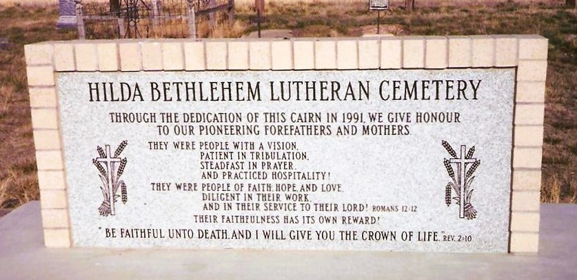
Nearest Populated Centre: Hilda,
Province: Alberta

Map Location

Latitude, Longitude
50.50622, -110.14031

Map Location

Search for:
RESET
Surname Given Name Born Died Age Photos Cemetery R Code

The 25 most common surnames found in this cemetery.

loader

The 25 most common given names found in this cemetery.

loader

Other Cemeteries

Westcott Cemetery (Mountain View County)

Westcott Rd & Range Rd 32 , Westcott , Alberta

St. Joseph's Cemetery (Three Hills, Kneehill County)

Secondary Highway 583 just west of Three Hills , Three Hills , Alberta

Quast Family Cemetery (Cypress County)

Twp Rd 160 & Rge Rd 23 , Schuler , Alberta

St. George’s Parish Cemetery (Irvine, Cypress County)

Township Road 119 & Range Road 30 , Irvine , Alberta

St. Joseph's Cemetery (Schuler, Cypress County)

Twp Rd 162 and Rge Rd 13 , Schuler , Alberta

Taylorville Cemetery (Cardston County)

Range Road 242A S of Township Road 14 , Taylorville , Alberta

Hilda Seventh Day Adventist Cemetery (Cypress County)

Twp Rd 182 & Rge Rd 13 , Hilda , Alberta

Fath Hill Cemetery (Vulcan County)

Rge Rd 529 west of Hwy 23 , Champion , Alberta

Harmattan Anglican Cemetery (Mountain View County)

Range Rd 40 S of Hwy 27 , Harmattan , Alberta

Cassils Pioneer Cemetery (Newell County)

Range Road 154 and Township Road 190 , Brooks , Alberta

Discover Alberta Ancestors