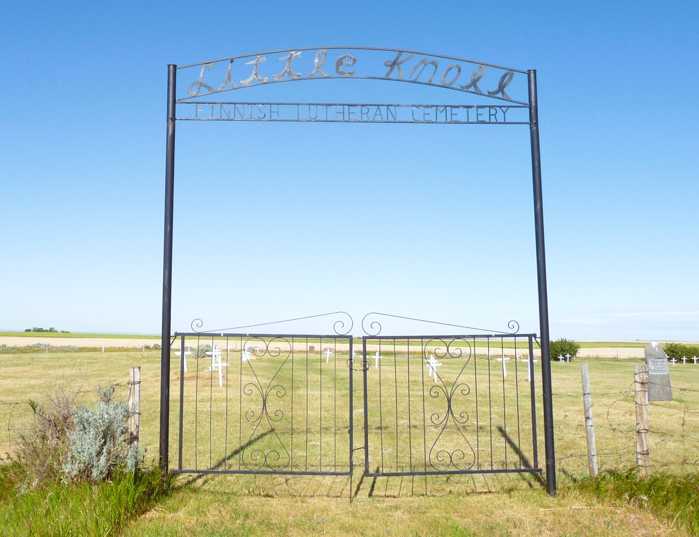
This is a unique Finnish cemetery is situated on land donated by Ole Baker and maintained by the Country of Forty Mile.

Driving directions – From Manyberries intersection with Highway 61, north on the Black and White Trail for three miles, one mile east on Twp. Rd. 62 (Elkwater Rd.), one mile north.

Courtesy of Medicine Hat and District Genealogical Society (MHDGS)

Deaths

Longevity

Address

Range Road 55 south of Township Road 62
Nearest Populated Centre: Manyberries,
Province: Alberta

Map Location

Latitude, Longitude
49.44983, -110.65668

Map Location

Search for:
RESET
Surname Given Name Born Died Age Photos Cemetery R Code

The 25 most common surnames found in this cemetery.

loader

The 25 most common given names found in this cemetery.

loader

Other Cemeteries

Leavitt Cemetery (Cardston County)

Range Road 265 N of Highway 5 , Leavitt , Alberta

Kuusamo Cemetery (Red Deer County)

Township Road 390 E of Range Road 23 , Sylvan Lake , Alberta

Reid Hill Cemetery (Vulcan County)

East of Vulcan at Rge Rd 230 , Vulcan , Alberta

Bottrel Cemetery (Rocky View County)

Range Rd 43 & Township Rd 283 , Bottrel , Alberta

Stirling Mennonite Cemetery (Warner County)

Range Road 195 S of Highway 52 , Stirling , Alberta

Gregoreshenko Family Cemetery (Cypress County)

Twp Rd 132 & Rge Rd 33 , Clearwater , Alberta

Rainy Hills Cemetery (Special Area No. 2)

Township Road 204 E of Range Road 103 , Iddesleigh , Alberta

Bradshaw Cemetery (Lacombe County)

Range Road 40 S of Township Road 414 , Leedale , Alberta

Duchess Cemetery (Newell County)

204075 Range Road 144 , Duchess , Alberta

Hutton-Pandora Cemetery (Special Area No. 2)

Township Road 242 E of Highway 36 , Hutton , Alberta

Discover Alberta Ancestors