Nemiscam, or Nemiskam, is an unincorporated community within the County of Forty Mile No. 8 in southern Alberta, Canada. The community is about 5 km east of Foremost and west of Etzikom, Alberta on Highway 61 and is administered by the County of Forty Mile.

Courtesy of Medicine Hat and District Genealogical Society (MHDGS)

Deaths

Longevity

Address

Highway 501 (Red Coat Trail) and Range Road 103
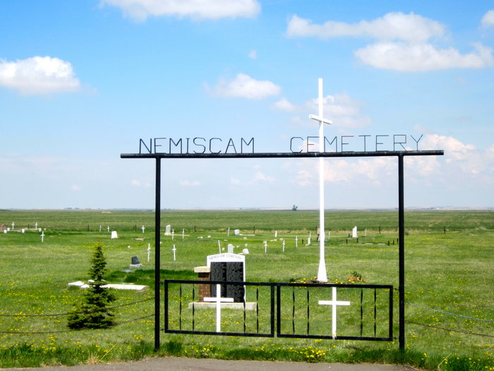
Nearest Populated Centre: Nemiskam,
Province: Alberta

Map Location

Latitude, Longitude
49.46548, -111.28504

Map Location

Search for:
RESET
Surname Given Name Born Died Age Photo(s) Cemetery Obituary Narrative R Code

The 25 most common surnames found in this cemetery.

loader

The 25 most common given names found in this cemetery.

loader

Other Cemeteries

Aetna Cemetery (Cardston County)

Range Road 251B SW of Town of Aetna , Aetna , Alberta

Norwegian Lutheran Cemetery (Cypress County)

Rge Rd 20 and Twp Rd 160 , Schuler , Alberta

Burnbrae Cemetery (Ponoka County)

Township Road 444 east of Highway 771 , Homeglen , Alberta

Kimball Cemetery (Cardston County)

Township Road 21 / Range Road 250(B) N of Kimball , Kimball , Alberta

Carstairs Cemetery (Mountain View County)

Gough Road , Carstairs , Alberta

Cremona Community Cemetery (Mountain View County)

Township Rd 295B & Highway 580 , Cremona , Alberta

Burnsland Cemetery (Calgary)

3020 Spiller Rd SE , Calgary , Alberta

Beiseker Community Cemetery (Rocky View County)

Range Rd 262, south of Township Rd 282 , Beiseker , Alberta

Christian Community of Universal Brotherhood Cemetery (Vulcan County)

Rge Rd 225 south of Twp Rd 205 , Arrowwood , Alberta

Kin Coulee Cemetery (Medicine Hat)

Old Cemetery Rd SE , Medicine Hat , Alberta

Discover Alberta Ancestors