
Township Road 63 and Range Road 50A
This cemetery is located in the County of Forty Mile. Directions are the intersection of Township Rd 63 and Range Road 50A. The cemetery is in a fenced area southwest of the intersection in a farmer’s field with the assumption that it is on private property.
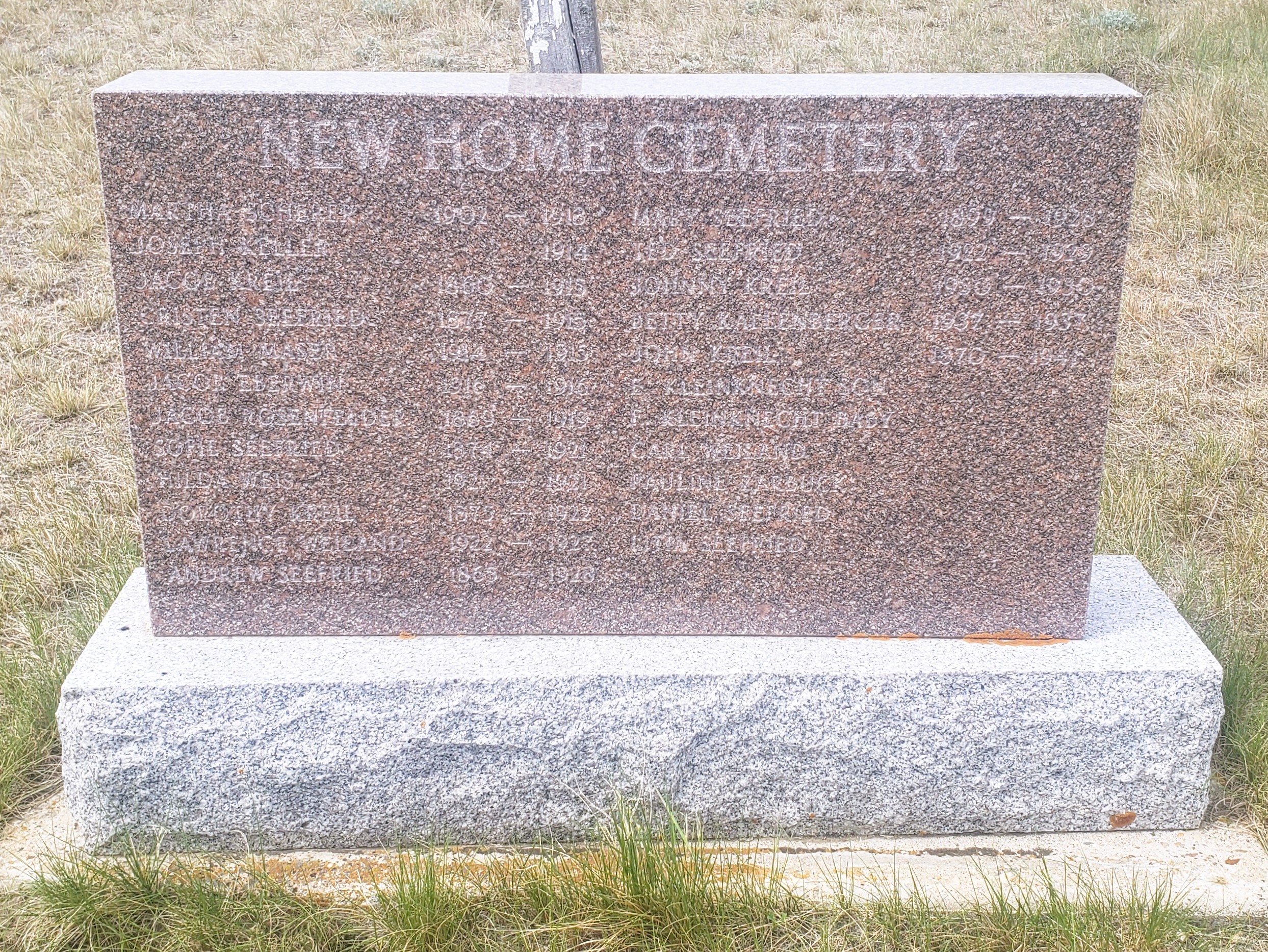
There is a memorial cairn but the lettering is hard to read and photograph. Each grave that does not have a headstone, has a white cross but with no names.
Find A Grave states that it is predominately German speaking settlers that are buried there. The County of Forty Mile maintains the cemetery.
Courtesy of Medicine Hat and District Genealogical Society (MHDGS)
Address
Township Road 63 and Range Road 50A
Nearest Populated Centre: Manyberries,
Province: Alberta
Map Location
Latitude, Longitude
49.47956, -110.56179
Map Location
| Surname | Given Name | Born | Died | Age | Photos | Cemetery | R Code |
|---|---|---|---|---|---|---|---|
The 25 most common surnames found in this cemetery.

The 25 most common given names found in this cemetery.