Bow Island is a town on Highway 3, approximately 50 kilometres southwest of Medicine Hat. According to legend, the names of Bow Island and Grassy Lake were accidentally confused and should have been transposed. The island feature whose name this town shares with is near Grassy Lake, almost 30 kilometres distant. Bow Island became a village in 1910 and a town in 1932.

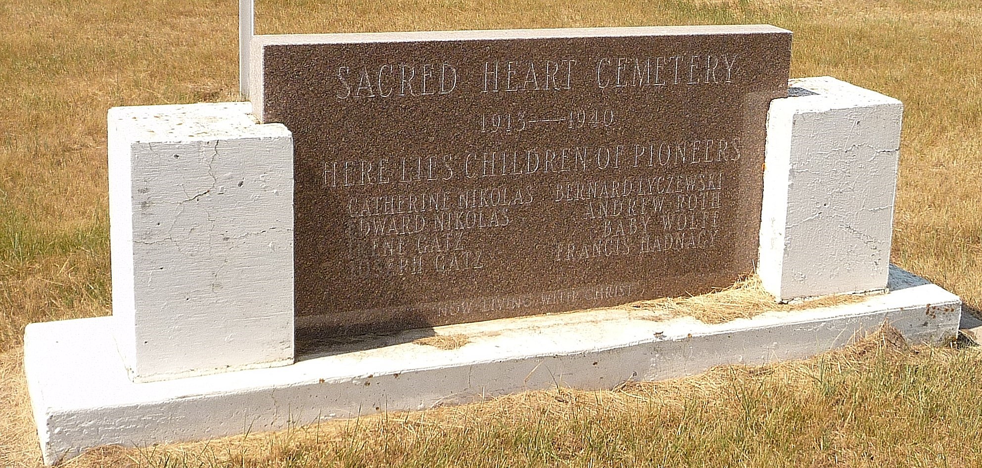
Courtesy of Medicine Hat and District Genealogical Society (MHDGS)

Deaths

Longevity

Address

Township Road 90 and Range Road 111
Nearest Populated Centre: Bow Island,
Province: Alberta

Map Location

Latitude, Longitude
49.6976, -111.38449

Map Location

Search for:
RESET
Surname Given Name Born Died Age Photos Cemetery R Code

The 25 most common surnames found in this cemetery.

loader

The 25 most common given names found in this cemetery.

loader

Other Cemeteries

Torrington West Cemetery (Kneehill County)

263074 Hwy 27 , Torrington , Alberta

Wrentham Cemetery (Warner County)

Highway 61 & Range Road 170 , Wrentham , Alberta

Kuusamo Cemetery (Red Deer County)

Township Road 390 E of Range Road 23 , Sylvan Lake , Alberta

Chevra Kadisha Erlton Street Cemetery (Calgary)

32 30th Ave SW , Calgary , Alberta

Big Prairie Cemetery (Mountain View County)

30314 Rg Rd 50 , Cremona , Alberta

Pincher Creek Pioneer Cemetery (MD of Pincher Creek)

Highway 6 and Veteran's Street , Pincher Creek , Alberta

Gnadenfeldt Baptist Cemetery (Cypress County)

Twp Rd 202 & Rge Rd 12 , Sandy Point , Alberta

Berry Creek Cemetery (Special Area No. 2)

Range Road 120 N of Township Road 284 , Berry Creek , Alberta

Quast Family Cemetery (Cypress County)

Twp Rd 160 & Rge Rd 23 , Schuler , Alberta

Rainier Cemetery (Newell County)

Range Road 161 S of Rainier , Rainier , Alberta

Discover Alberta Ancestors