
Township Road 41 and Range Road 100
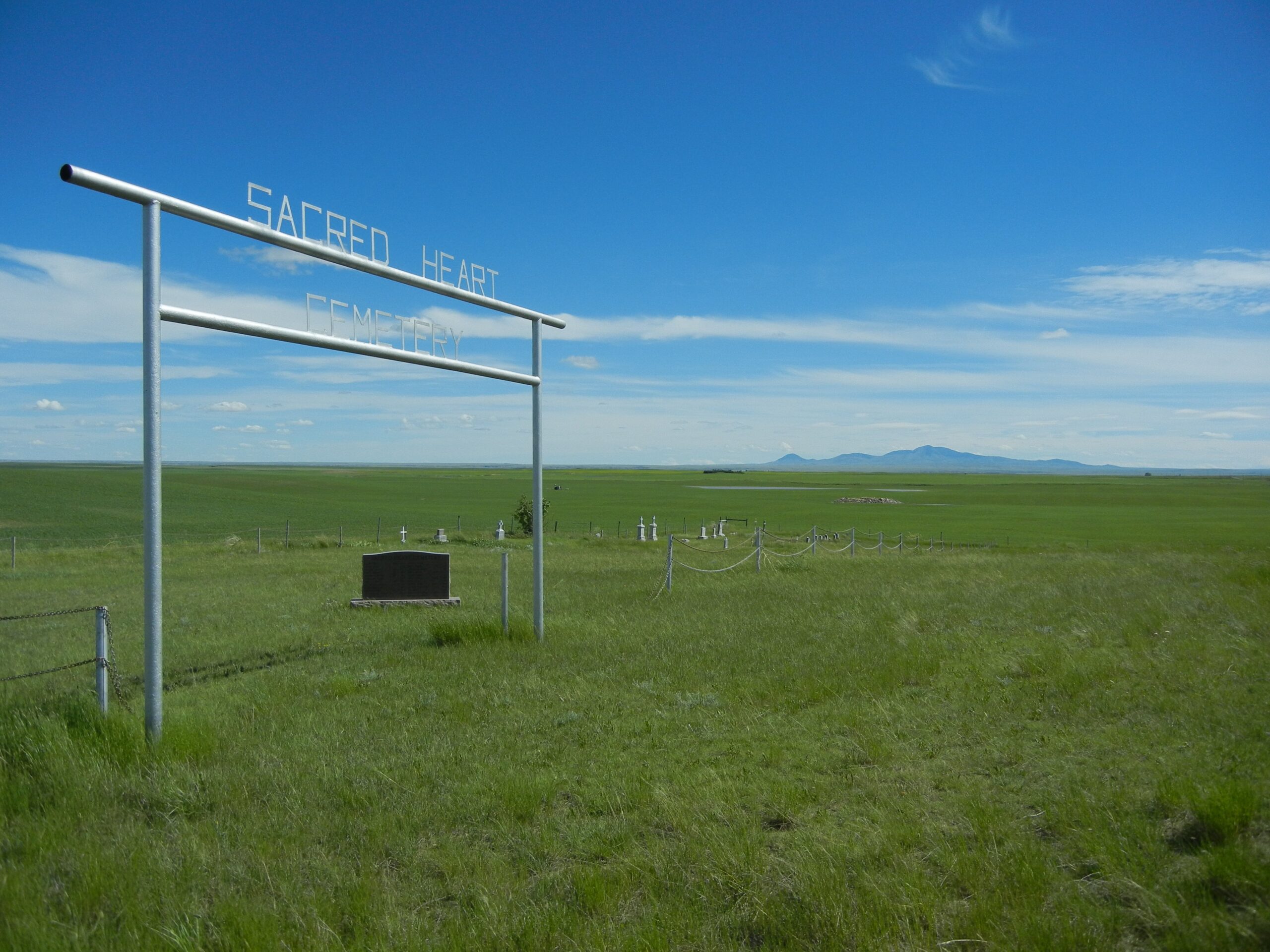
The Sacred Heart cemetery is identified on the County map as Altorado Sacred Heart to differentiate it from a second Sacred Heart cemetery in the county. The cemetery is also known as Altorado Cemetery/. Provincial and County records are under Altorado although the cemetery sign simply reads “Sacred Heart Cemetery”. The Cemetery is located behind an abandoned white church east of Range Road 100 and north of Township Road #40 at 40081 Range Road 100.
About 11 kilometres south of Nemiskam, there was once a near-mythical place called Altorado, which by 1913 was a booming concern of about 100 people. As with so many other new communities, it had a moniker controversy. Some local historians suggest its name was meant to be El Dorado, which metaphorically meant to be applied to any place of great abundance, or one where dreams of opportunity and riches could be realized. There would be no riches or long-term future for Altorado. The hoped for railway way extension through the community never happened. The CPR decided to extend the line north of Altorado, leaving the community stranded and doomed for the ghosts.
The community was originally settled during the creation of a Canadian Pacific Railway line from Weyburn, Saskatchewan to Stirling, Alberta in an attempt to profit from railway trade. During 1912 – 1913, pioneers, mainly Mormons, settled at Altorado, located southeast of present-day Foremost. By 1913, the population was in the neighborhood of 100 people, and the town boasted a doctor, a post office, two general stores, and three blacksmiths.
However, in 1913, the line bypassed the community and began the town of Foremost, and the community became non-viable.
Courtesy of Medicine Hat and District Genealogical Society (MHDGS)
Address
Township Road 41 and Range Road 100
Nearest Populated Centre: Nemiskam,
Province: Alberta
Map Location
Latitude, Longitude
49.27521, -111.21408
Map Location
| Surname | Given Name | Born | Died | Age | Photos | Cemetery | R Code |
|---|---|---|---|---|---|---|---|
The 25 most common surnames found in this cemetery.

The 25 most common given names found in this cemetery.