
Twp Rd 162 and Rge Rd 13
Early Catholic families practiced their faith when priests would make a traveling circuit throughout the scattered settlements. The first mass in the Schuler district was celebrated in the Emmanuel Hagel home in 1911 by Father F.X. Erme. The early priests were able to travel the rails free in deference to Father Lacombe’s work for the railway. After the first good crop, the pioneers took a collection and built a church on the Tony Zahn property. The land for the cemetery across the road was donated by Adam Neigel.
The church was built in 1917 without the bishop’s help or knowledge. Mass was said only once per month. The church was used every Sunday for teaching catechism and for prayers and Rosary for the entire congregation. The church was named at the suggestion of a traveling missionary. The hamlet of Schuler was built one mile west of the church in 1923. In 1930 a new church under the auspices of Bishop Kidd, was erected with mostly volunteer help. The old church was converted into use as the rectory. The new church was blessed August 31, 1930, and has since been enlarged.
St. Joseph’s can boast of having had the present bishop of Calgary, Alberta, as their parish priest for seven years. The hamlet has also produced Father Leo Hagel (a Benedictine), also two diocesan priests, Father John Weisgerber and Father Leonard Hagel. Four girls; Frances Wetsch, Veronica Schafer, Victoria Hagel and Virginia Hagel entered the religious life. The first recorded baptisms were Katherine Wetsch in 1911 and Anthony Zahn in 1912. The first to be baptized in the new church was Frances Hagel in 1930. The first two marriages in the new church were between Louis Grossman and Rosie Hagel and between Anthony Schafer and Eugenia Aberle.
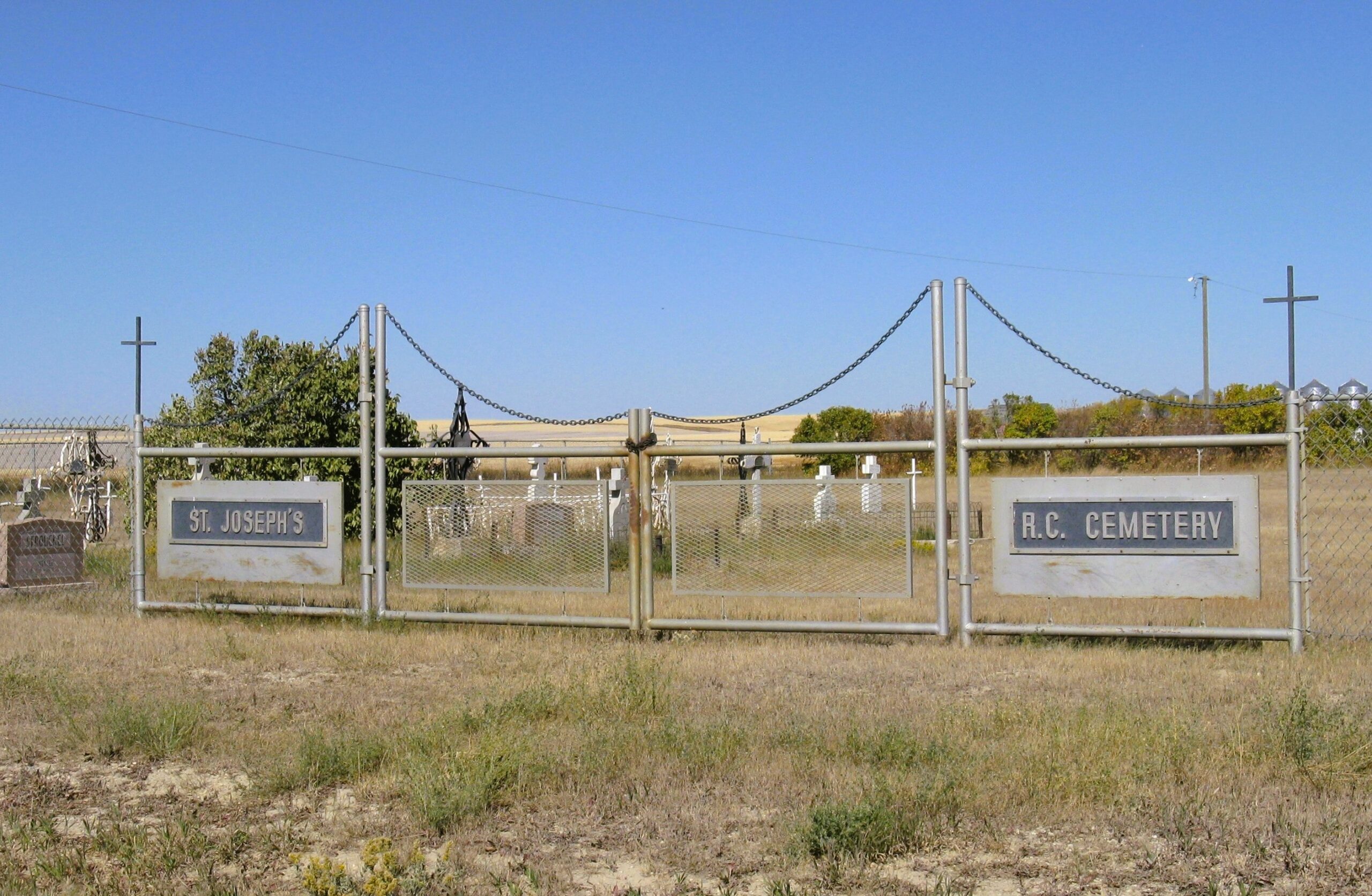
The cemetery is located about one mile east of Schuler, Alberta, on the north side of Township Road 162 and east of Range Road 13. Two new monuments have been erected recently, one lists donors for the improvement project and the other shows an incomplete list of interments. The monument shows only the age of deceased at death rather than birth or death dates. An attempt was made to place a durable, white metal cross at each grave, but some burial sites are not known. This location has been inactive since 1956.
Information courtesy of Medicine Hat and District Genealogical Society (MHDGS)
Address
Twp Rd 162 and Rge Rd 13
Nearest Populated Centre: Schuler,
Province: Alberta
Map Location
Latitude, Longitude
50.33947, -110.07306
Map Location
| Surname | Given Name | Born | Died | Age | Photos | Cemetery | R Code |
|---|---|---|---|---|---|---|---|
The 25 most common surnames found in this cemetery.

The 25 most common given names found in this cemetery.