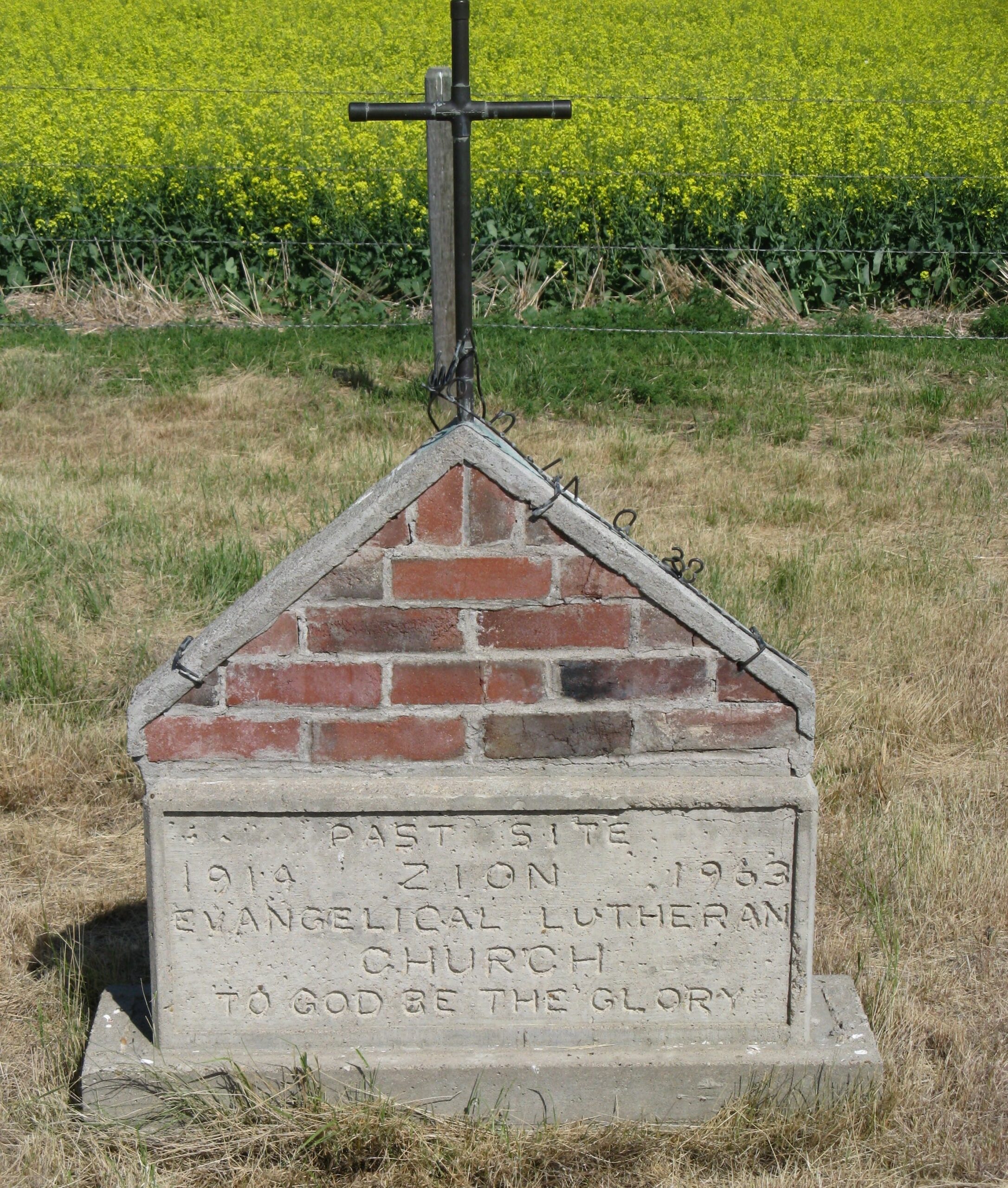
Site 2 is the second site of the Zion Lutheran Church in Hilda, Alberta. In 1923, the church and cemetery were moved to this location, nine miles west and one and a half miles north of Hilda, Alberta, or 1/2 mile south of Township Road 182 and Range Road 24 on the Fred Dewald homestead. The small quarter acre plot is about 100 yards east of the road, is fenced but the grass was uncut as at August 12, 1995.

Information courtesy of Medicine Hat and District Genealogical Society (MHDGS)

Deaths

Longevity

Address

Twp 180 and Rge Rd 24
Nearest Populated Centre: Hilda,
Province: Alberta

Map Location

Latitude, Longitude
50.50740, -110.23295

Map Location

Search for:
RESET
Surname Given Name Born Died Age Photos Cemetery R Code

The 25 most common surnames found in this cemetery.

loader

The 25 most common given names found in this cemetery.

loader

Other Cemeteries

Bellevue Catholic Cemetery (Crowsnest Pass)

Bellevue , Bellevue , Alberta

Hainstock Cemetery (Mountain View County)

Highway 27; 5 km west of Olds , Olds , Alberta

Little Knoll Finnish Lutheran Cemetery (Forty Mile County)

Range Road 55 south of Township Road 62 , Manyberries , Alberta

Glenwood Cemetery (Cardston County)

Highway 810 N of Range Road 52 , Highway 810 N of Range Road 52 , Alberta

Arrowwood Cemetery (Vulcan County)

Range Rd 233 just south of Twp Rd 205 , Arrowwood , Alberta

St. Patrick Cemetery (Calgary)

14608 Macleod Tr SE (access off 146 Ave SE & Bannister Rd) , Calgary , Alberta

Faith Union Cemetery (Forty Mile County)

Township Road 42 and Highway 885 , Etzikom , Alberta

Mayton Cemetery (Mountain View County)

27359 Twp Rd 333 , Mayton , Alberta

Bloomsbury Pentecostal Cemetery (Barrhead County)

Township Road 604 and Range Road 35 , Bloomsbury , Alberta

Discover Alberta Ancestors