
4455 Twp Rd 340
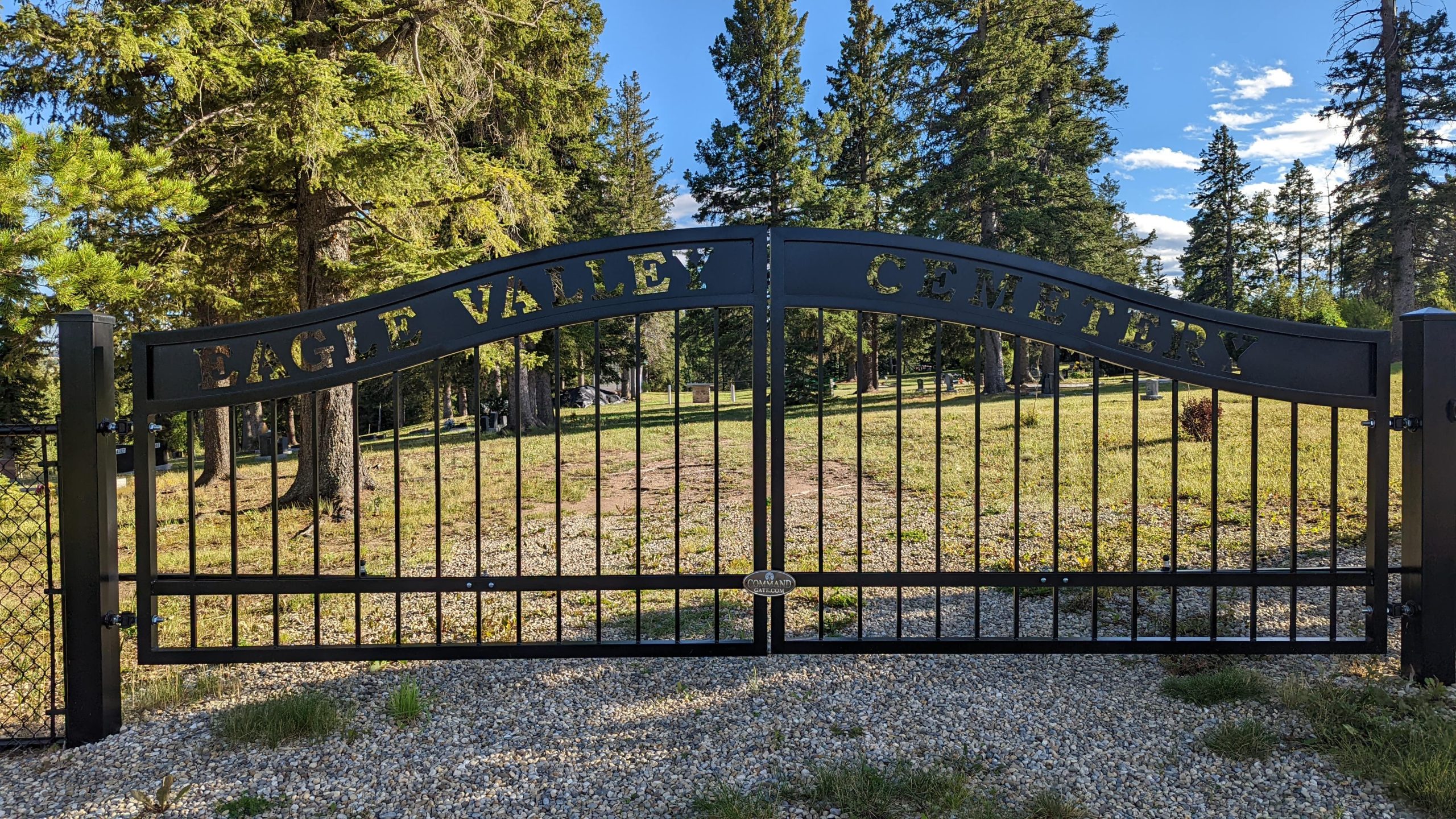
Eagle Valley Cemetery is located a 15-minute drive northeast of the town of Sundre. Take Highway 27 east for 8 km, head north on Range Road 44 for 10 km, then turn west onto Township Road 340. Then go west about 1 km. On the south side of the road will be the entrance to the Forest Heights Golf Course. Between the Golf Course entrance and Township Road 340, there is a dirt road. Follow the dirt road east up the hill. The cemetery will be on the right. As of 2022, Eagle Valley Cemetery has 387 interments.
Town of Sundre
Sundre is located on the banks of the Red Deer River in the foothills of the Rocky Mountains, 100 km Northwest of Calgary. It is a major service centre for the area’s industries which include Oil & Gas, Lumber & Forestry, farming, ranching, recreation & tourism. Sundre was named so in 1909 by the town’s first postmaster Nels T. Hagen, after his hometown in Norway. Sundre incorporated as a village in 1950 and incorporated as a town on January 1, 1956. Main industries in the area are petroleum production, forestry, agriculture, and ranching. Cultural venues within Sundre include the Sundre Municipal Library and the Sundre & District Pioneer Village Museum, which features “Chester Mjolsness’ World of Wildlife” exhibit of 150 taxidermy animals from across the world. In 2021, Sundre had a population of 2,672.
Address
4455 Twp Rd 340
Nearest Populated Centre: Sundre,
Province: Alberta
Map Location
Latitude, Longitude
51.88229, -114.53369
Map Location
| Surname | Given Name | Born | Died | Age | Photos | Cemetery | R Code |
|---|---|---|---|---|---|---|---|
The 25 most common surnames found in this cemetery.

The 25 most common given names found in this cemetery.