Courtesy of Medicine Hat and District Genealogical Society (MHDGS)

Deaths

Longevity

Address

Twp Rd 100 & Range Rd 12 (Graburn Road)
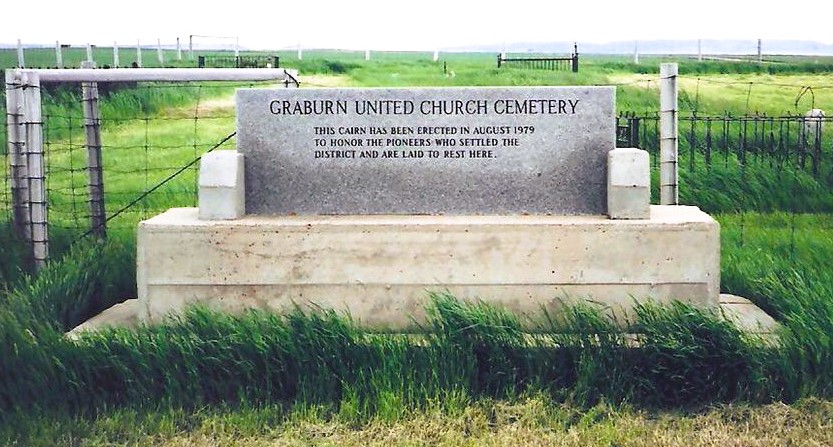
Nearest Populated Centre: Walsh,
Province: Alberta

Map Location

Latitude, Longitude
49.78545, -110.04853

Map Location

Search for:
RESET
Surname Given Name Born Died Age Photo(s) Cemetery Obituary Narrative R Code

The 25 most common surnames found in this cemetery.

loader

The 25 most common given names found in this cemetery.

loader

Other Cemeteries

Beiseker Zion United Cemetery (Rocky View County)

Range Rd 272 west of Range Rd 253 , Beiseker , Alberta

Burnbrae Cemetery (Ponoka County)

Township Road 444 east of Highway 771 , Homeglen , Alberta

Lebanon-Thelma Cemetery (Cypress County)

Twp Rd 74 & Range Rd 31 , Irvine , Alberta

Faith Union Cemetery (Forty Mile County)

Township Road 42 and Highway 885 , Etzikom , Alberta

Bauder Family Cemetery (Cypress County)

Twp Rd 143 & Rge Rd 11 , Many Islands Lake , Alberta

Sunnynook Cemetery (Special Area No. 2)

Township Road 272 E of Range Road 124A , Hanna , Alberta

Youngstown Cemetery (Special Area No. 3)

Highway 884 just S of Youngstown , Youngstown , Alberta

Spring Coulee Cemetery (Cardston County)

Range Road 234 N of Spring Coulee , Spring Coulee , Alberta

Dakota Cemetery (Ponoka County)

434015 Range Rd 273 , Ponoka , Alberta

Wimborne Cemetery (Kneehill County)

334039 Hwy 805 , Wimborne , Alberta

Discover Alberta Ancestors