
Front St & First Ave
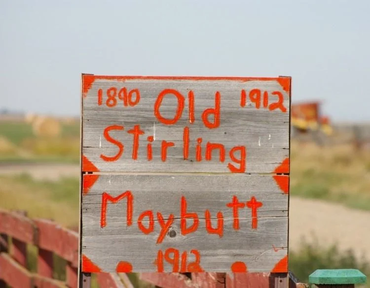
Maybutt, originally known as “New Stirling,” was founded around 1910 in the County of Warner No. 5, just north of the village of Stirling. The cemetery emerged during a brief but ambitious period when the town was envisioned as a key railway junction between the Canadian Pacific Railway branch lines—a place expected to become a hub for settlers and commerce.
Despite the town’s ambitious beginnings—including a 50‑room hotel, a newspaper, general store, and lumber yard—the settlement did not flourish. As Maybutt declined, so too did the need for its cemetery. Today, only three known graves remain:
- Jens Jorgenson, a bachelor farmer who lived northwest of Maybutt
- Mr. Watson
- A young Seiger boy, tragically killed in an accidental shooting; his father had been manager of the local lumber yard.
This minimal cemetery quietly preserves these solitary pieces of the community’s history.
By the mid‑1920s, Maybutt was hit hard by poor crop yields, drought, and the Dust Bowl era—factors that drove many residents away. Key buildings like the school were never built; children were instead bused to Stirling beginning in 1924. As the town dwindled, essential services like the post office and service station shut down, and Maybutt officially lost its hamlet status in 1970.
Maybutt Cemetery stands as one of the few enduring remnants of this ghost town. Its handful of graves serves not just as memorials to individuals, but as markers of a community that once held great promise. The site is a poignant relic reminding us of the past hopes, struggles, and stories written on Alberta’s prairie landscape.
Address
Front St & First Ave
Nearest Populated Centre: Maybutt,
Province: Alberta
Map Location
Latitude, Longitude
49.51844, -112.52836
Map Location
| Surname | Given Name | Born | Died | Age | Photos | Cemetery | R Code |
|---|---|---|---|---|---|---|---|
The 25 most common surnames found in this cemetery.

The 25 most common given names found in this cemetery.