
Excelsior Avenue
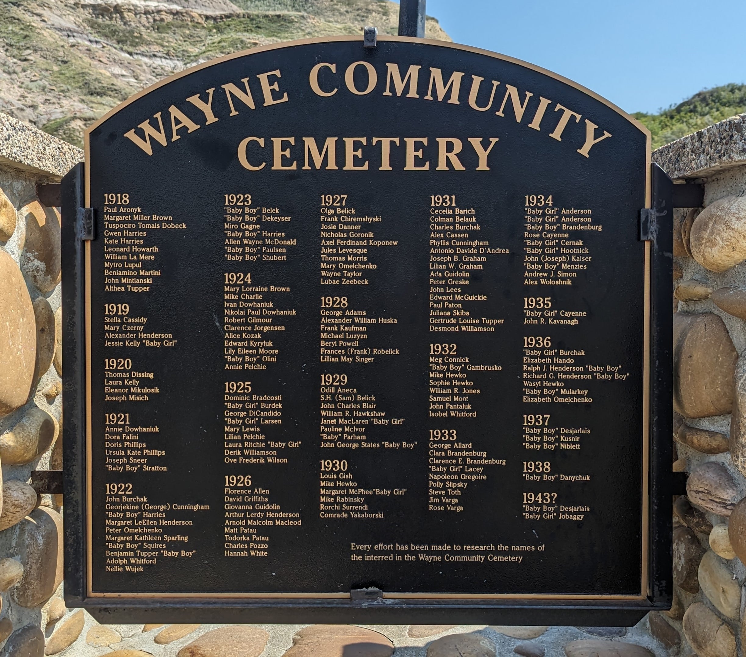
The first coal mine in the surrounding Kneehill Canyon opened in 1912 and soon there was a string of coal mine camps along the canyon. Wayne was never an organized settlement such as a hamlet or village, but took its name from the post office. It was named after a boy whose surname has long been forgotten. Wayne was without a mayor or council, and the coal mine companies ruled the area. Everyone lived in company houses and shopped in company stores, and the mine supervisors were the governors of the canyon. The only access was via the railroad until the late 1920s, when a wagon trail was blazed alongside the track, many years later to become a road. George V. Tupper was the first postmaster, opening the post office on 1915-08-01 and giving the place its name.
Address
Excelsior Avenue
Nearest Populated Centre: Wayne,
Province: Alberta
Map Location
Latitude, Longitude
51.38473, -112.65409
Map Location
| Surname | Given Name | Born | Died | Age | Photos | Cemetery | R Code |
|---|---|---|---|---|---|---|---|
The 25 most common surnames found in this cemetery.

The 25 most common given names found in this cemetery.