Nemiscam, or Nemiskam, is an unincorporated community within the County of Forty Mile No. 8 in southern Alberta, Canada. The community is about 5 km east of Foremost and west of Etzikom, Alberta on Highway 61 and is administered by the County of Forty Mile.

Courtesy of Medicine Hat and District Genealogical Society (MHDGS)

Deaths

Longevity

Address

Highway 501 (Red Coat Trail) and Range Road 103
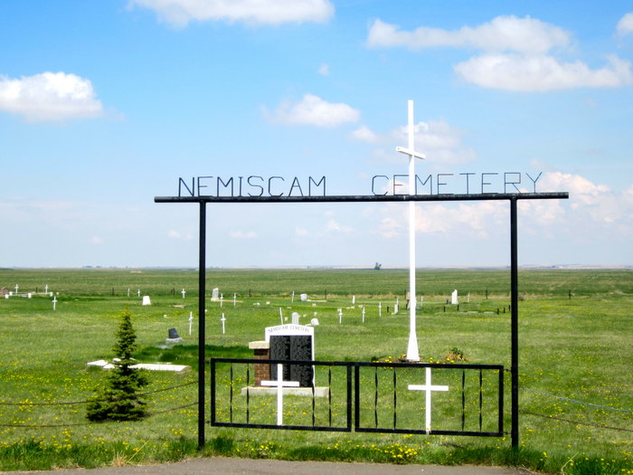
Nearest Populated Centre: Nemiskam,
Province: Alberta

Map Location

Latitude, Longitude
49.46548, -111.28504

Map Location

Search for:
RESET
Surname Given Name Born Died Age Photo(s) Cemetery Obituary Narrative R Code

The 25 most common surnames found in this cemetery.

loader

The 25 most common given names found in this cemetery.

loader

Other Cemeteries

Congregational Matthaus Cemetery (Cypress County)

Rge Rd 23 between Twp Rs 154 and 160 , Schuler , Alberta

Beiseker Level Land Seventh-day Adventist Cemetery (Rocky View County)

Range Rd 242, south of Highway #9 , Beiseker , Alberta

Coleman Union Cemetery (Crowsnest Pass)

27 Ave & 28 Ave , Coleman , Alberta

Rocky View Garden of Peace Cemetery (Calgary)

243208 Garden Rd NE , Just outside Calgary city limits , Alberta

Bloomsbury Pentecostal Cemetery (Barrhead County)

Township Road 604 and Range Road 35 , Bloomsbury , Alberta

Stockburger Cemetery (Cypress County)

Township Road 190 and Range Road 20 , Hilda , Alberta

Christian Community of Universal Brotherhood Cemetery (Vulcan County)

Rge Rd 225 south of Twp Rd 205 , Arrowwood , Alberta

Gaetz Cemetery (Clearwater County)

Range Road 41 S of Township Road 380 , Condor , Alberta

Okotoks Cemetery (Foothills County)

30 Westland Street , Okotoks , Alberta

Alston Cemetery (Vulcan County)

Hwy 527 & Twp Rd 142; SW of Champion , SW of Champion , Alberta

Discover Alberta Ancestors