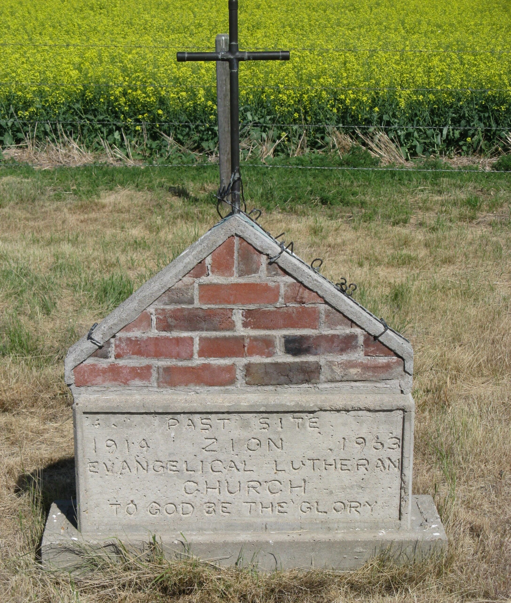
Site 2 is the second site of the Zion Lutheran Church in Hilda, Alberta. In 1923, the church and cemetery were moved to this location, nine miles west and one and a half miles north of Hilda, Alberta, or 1/2 mile south of Township Road 182 and Range Road 24 on the Fred Dewald homestead. The small quarter acre plot is about 100 yards east of the road, is fenced but the grass was uncut as at August 12, 1995.

Information courtesy of Medicine Hat and District Genealogical Society (MHDGS)

Deaths

Longevity

Address

Twp 180 and Rge Rd 24
Nearest Populated Centre: Hilda,
Province: Alberta

Map Location

Latitude, Longitude
50.50740, -110.23295

Map Location

Search for:
RESET
Surname Given Name Born Died Age Photo(s) Cemetery Obituary Narrative R Code

The 25 most common surnames found in this cemetery.

loader

The 25 most common given names found in this cemetery.

loader

Other Cemeteries

Seven Persons Cemetery (Cypress County)

Township Road 110 east of Highway 867 , Seven Persons , Alberta

St. Mary's Cemetery (Beiseker, Rocky View County)

Township Rd 282 & Range Rd 261 , Beiseker , Alberta

Cravath Corners Cemetery (Wardlow, Special Area No. 2)

Range Road 513 S of Cessford , Wardlow , Alberta

Swalwell Cemetery (Kneehill County)

295037 Rge Rd 243 , Swalwell , Alberta

Newburg Evangelical Zion Cemetery (Cypress County)

Twp Rd 100 & Rge Rd 41 , Gros Ventre , Alberta

Manyberries Cemetery (Forty Mile County)

Highway 61 (Red Coat Trail) and Range Road 53b , Manyberries , Alberta

Bellevue Union Cemetery (Crowsnest Pass)

Larch Ave , Bellevue , Alberta

Standard Cemetery (Wheatland County)

Highway 840 & Cemetery Road , Standard , Alberta

Strathmore Cemetery (Wheatland County)

Westridge Road; adjacent to Hwy 1 , Strathmore , Alberta

Nemiscam Cemetery (Forty Mile County)

Highway 501 (Red Coat Trail) and Range Road 103 , Nemiskam , Alberta

Discover Alberta Ancestors