
1st St East
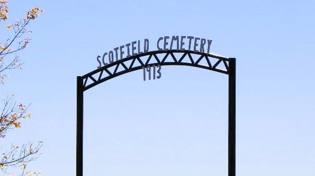
The Scotfield Cemetery was established on December 9, 1915, when local farmer Thos McKeague donated an acre of his land for its creation. The men of the community came together to erect a fine iron fence around the cemetery. Over the years, the cemetery has become a resting place for many of Scotfield’s residents.
Scotfield itself is a hamlet located in east-central Alberta, under the jurisdiction of the Special Areas Board. Its history is deeply intertwined with the development of Alberta’s agricultural industry. Established by settlers in the early 20th century, Scotfield quickly grew as a farming community. The fertile lands of Alberta provided the perfect conditions for crops, and Scotfield became known for its abundant harvests.
Address
1st St East
Nearest Populated Centre: Scotfield,
Province: Alberta
Map Location
Latitude, Longitude
51.56138, -111.32897
Map Location
| Surname | Given Name | Born | Died | Age | Photos | Cemetery | R Code |
|---|---|---|---|---|---|---|---|
The 25 most common surnames found in this cemetery.

The 25 most common given names found in this cemetery.